REVIEW 3 major objections 5 minor 79 references
A compact tree inventory—positions, diameters, and base heights—can replace dense point clouds for global forest localization, achieving centimeter-level per-match pose accuracy across seasons and sensors.
Reviewed by Pith at T0; open to challenge. T0 means a machine referee read the full paper against a public rubric. the ladder, T0–T4 →
TreeLoc++ localizes a forest robot with 6-DoF centimeter accuracy using only compact tree inventories — positions and diameters — beating point-cloud-backed methods on 27 sequences in four countries.
T0 review reviewed 2026-08-02 challenge →
load-bearing objection TreeLoc++ is a careful, well-evaluated incremental extension of the same group's TreeLoc; the 'global' label is softened by a spatial prior and the base-height dependency is the weak link. the 3 major comments →
TreeLoc++: Robust 6-DoF LiDAR Localization in Forests with a Compact Digital Forest Inventory
The pith
A machine-rendered reading of the paper's core claim, the machinery that carries it, and where it could break.
The reading
Core claim
The central claim is that a Digital Forest Inventory is not only a forestry product but also a discriminative map representation for global localization. TreeLoc++ encodes each local inventory with two complementary histograms—a tree-distribution histogram and a pairwise-distance histogram—then indexes triangles formed by stem centers into hash tables. It rejects false correspondences using diameter-at-breast-height (DBH) consistency and yaw-consistent inlier voting before jointly solving roll, pitch, and height via a constrained optimization that treats tree axes and base heights as geometric constraints. The result is a place-recognition and 6-DoF pose-estimation pipeline that works withou
What carries the argument
The central mechanism is the tree-axis-based 2D projection: stem-axis orientations are aligned to a common vertical direction before projecting stem centers, canceling roll and pitch differences between viewpoints while leaving yaw for the matcher. On this projected plane, the pairwise-distance histogram (PDH) and 2D triangle hash descriptor capture inter-tree geometry; refinement uses DBH filtering and yaw-consistent inlier voting. The vertical-correction equation then maps base-height differences and small residual tilts into a height and roll-pitch correction, which is what lifts the matcher from 3-DoF to full 6-DoF.
Load-bearing premise
The inventory's geometric attributes—stem center, diameter, base height, and stem axis—must be accurate and consistent enough across sensors, seasons, and viewpoints that every downstream matching and optimization stage can treat them as trustworthy; if base heights are biased by occlusion or field-of-view limits, the 6-DoF refinement inherits that bias.
What would settle it
Measure the actual base heights of matched trees with a survey-grade instrument (e.g., a total station) in a sequence where the sensor field of view partially occludes the ground; if the difference between measured and inventory base heights correlates with the roll/pitch/height residuals of the vertical-correction equation, the claimed 6-DoF accuracy fails in exactly the occlusion cases the paper lists as a limitation.
If this is right
- If tree inventories suffice as maps, long-term forest monitoring no longer requires storing or re-visiting raw point clouds, cutting map storage by orders of magnitude (kilobytes vs. gigabytes).
- Being hand-crafted and free of learned features, the descriptors transfer across different forests and sensors without training or site-specific tuning, as shown by the two-year and cross-country evaluations.
- The per-match accuracy in the 1–10 m range (2D ATE roughly 0.017–0.067 m) suggests these constraints are precise enough to serve as loop closures in pose-graph optimization.
- The fixed-threshold stability of the overlap score implies that a single deployment threshold works without per-session recalibration, which the paper demonstrates across session pairs.
- Because the pipeline runs in under 10 ms per query, on-demand descriptor computation is practical, enabling incremental inventory updates during a mission.
Where Pith is reading between the lines
- The paper notes performance degrades in open areas where trees are sparse and distant; a natural extension is a hybrid mode that falls back to GNSS in open terrain and switches to inventory matching when tree density is sufficient, a strategy the authors gesture at but do not evaluate.
- The 6-DoF refinement depends on base heights, so systematic bias in base-height estimation (from limited sensor FoV or terrain occlusion) would directly bias the height/roll-pitch output; independently measuring base-height error would bound the claimed 6-DoF accuracy.
- The triangle-hash multiset scoring could be reused for other landmark types with stable geometric attributes (e.g., poles, rocks), potentially generalizing the method beyond forests.
- The paper's cascaded top-100/top-10 retrieval with low-dimensional histograms suggests the approach can scale to larger databases than the tested 6,918 entries, but this scaling is not demonstrated explicitly.
Editorial analysis
A structured set of objections, weighed in public.
Referee Report
Summary. TreeLoc++ proposes a forest localization pipeline that replaces dense point-cloud maps with Digital Forest Inventories (DFIs) containing per-tree attributes (stem center, axis orientation, DBH, base height). It extends TreeLoc with a pairwise-distance histogram for coarse retrieval, DBH filtering and yaw-consistent voting for outlier rejection, and a constrained 6-DoF refinement that jointly estimates roll, pitch, and height from matched tree geometry. The system is evaluated on 27 sequences from the Oxford Forest Place Recognition dataset, Wild-Places, and a newly collected Evo25 set, reporting state-of-the-art place recognition recall, centimeter-level per-match pose errors, compact map sizes (250 KB for 15 Evo sessions), and fast runtime.
Significance. If the results hold, this is a valuable contribution: it demonstrates that a compact, interpretable forest inventory can support global localization across sessions, seasons, and different LiDAR sensors without storing raw point clouds. The empirical scaffolding is unusually thorough — three datasets, per-component ablations (Tables 9–11), a viewpoint-rotation stress test (Table 7), a threshold-dependence study (Appendix E), and an explicit limitations section. The method is training-free and the paper states an open-source release, both of which strengthen reproducibility. The main weakness is that the 6-DoF refinement depends on base-height estimates whose accuracy is not independently validated, and the headline 'centimeter-level' claim conflates per-match pose errors with trajectory-level errors.
major comments (3)
- [§VI and Eq. (13)] The full 6-DoF claim rests on the accuracy of the estimated base heights b'. Equation (13) directly maps base-height residuals into (Δz, Δϕ, Δψ), and Table 11 shows that the vertical correction changes ATE from 0.099–0.152 m to 0.080–0.087 m — so this correction is material. However, no independent ground-truth comparison of base heights is provided, and the limitations section admits that FoV occlusion or terrain occlusion can force base heights to be approximated. The statement in §VI that the error increase 'remains at the centimeter level' is not quantified and is not supported by a sensitivity analysis. I would like to see either (i) validation of base heights against manual/TLS measurements, (ii) a perturbation study that adds realistic base-height biases and reports resulting ATE/ARE, or (iii) separate reporting of roll/pitch/z errors for the vertical-correction stage. Without thi
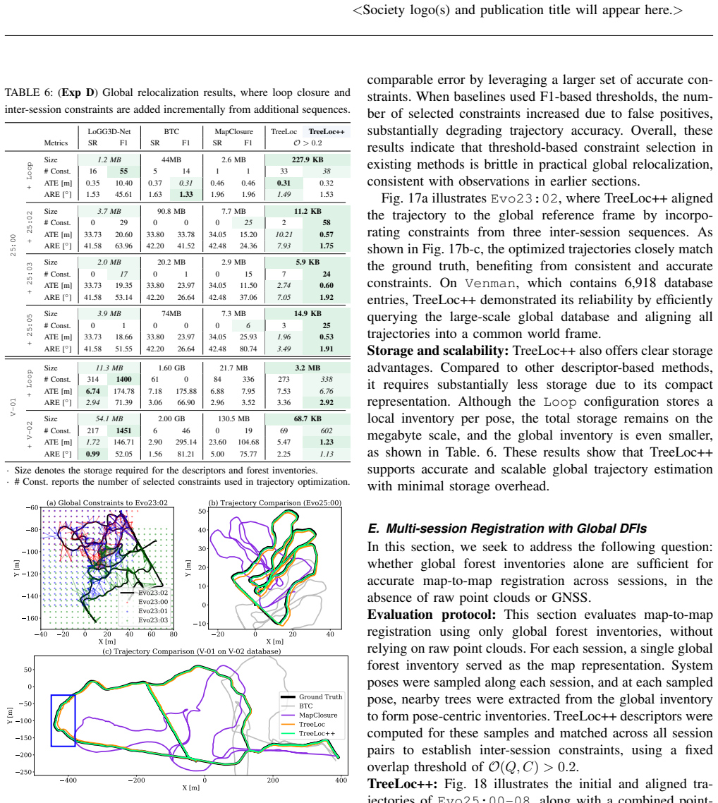
- [Abstract and Table 6] The abstract and conclusion state that TreeLoc++ achieves 'centimeter-level accuracy.' This is supported by per-match pose errors in Table 4 (2D ATE 0.038–0.046 m, 3D ATE 0.068–0.087 m), but Table 6 reports substantially larger trajectory-level ATE values after global relocalization (0.31–0.60 m on Evo25, and up to 6.76 m on Venman). The claim should be qualified: centimeter-level accuracy applies to individual query-to-map pose estimates, not to the multi-session trajectory alignment. This is a presentation issue, but it is load-bearing for the paper's headline and should be corrected.
- [§V-A and Appendix B] The main comparison against learning-based baselines is harder to interpret than presented. In Table 2, learning-based methods are evaluated on Oxford Forest after training on Wild-Places (or with urban pretrained checkpoints), while Table 3 evaluates them on Wild-Places with in-domain training. Appendix B shows that in-domain training materially improves these baselines, yet TreeLoc++ still outperforms them. The main-text claim 'outperforms both hand-crafted and learning-based baselines' is therefore only supported for a mixed protocol; the paper should state the training domain for each baseline in the main tables, and ideally include the in-domain variants in the main comparison. Otherwise a reader cannot tell how much of the margin is due to the method itself versus an unfavorable training setup for the baselines.
minor comments (5)
- [Eq. (15)] The spatial proximity prior p(||t||) uses a scaling parameter σ_t, but its value is never reported. Since this prior directly affects R@1 and MR (as acknowledged in §V-A), a sensitivity study on σ_t (or at least the chosen value) should be reported.
- [Abstract] The abstract at the top of the manuscript says TreeLoc++ is 'open-sourced' with a GitHub URL, while the abstract in the main body says 'Code and datasets will be released.' Please harmonize these statements.
- [§III-C] TDH is described as an n_r × n_d histogram smoothed and flattened into a 40-dimensional descriptor, and PDH is described as 40-dimensional. Since the number of bins is not stated explicitly for either descriptor, the reader cannot reproduce the descriptor sizes. Please report n_r, n_d, n_bins, and the overlap parameters.
- [§VI] The sentence 'the error increase from 3-DoF to 6-DoF alignment remains at the centimeter level' is ambiguous: it could mean the additional error introduced by 6-DoF estimation is only a few centimeters, or that the total error remains a few centimeters. Please rephrase and provide the supporting numbers.
- [Table 14] The footnote says the translation penalty was disabled during candidate selection for this benchmark. This is an important detail and should also appear in the main text near the discussion of Table 14, because the comparison with registration baselines uses a different scoring setup from the rest of the paper.
Circularity Check
No significant circularity: TreeLoc++'s derivation is a self-contained geometric pipeline, externally benchmarked; self-citations to TreeLoc and RealtimeTrees are not used to force the claims.
full rationale
The paper's localization chain is built from hand-crafted geometric operations: axis alignment (Eq. 1), TDH/PDH histograms, triangle hashing (Eq. 3), DBH filtering (Eq. 6), yaw voting (Eq. 7), planar alignment (Eqs. 8-9), roll/pitch from stem axes (Eq. 11), vertical correction on base heights (Eq. 13), and final 6-DoF composition (Eq. 14). None of these equations takes the evaluation metric or ground-truth pose as an input; each stage is defined from DFI attributes and produces a pose estimate. The vertical correction in Eq. (13) is a least-squares/RANSAC fit over matched base heights, not a fit to the ATE values used later to measure accuracy. The DFI construction is delegated to RealtimeTrees [35], an external published system (with some author overlap), and the end-to-end pipeline is evaluated against independent datasets (Wild-Places, Oxford Forest, Evo). No uniqueness theorem or prior result by the same authors is invoked to preclude alternatives. The overlap score in Eq. (15) includes a spatial proximity prior favoring small estimated translations, and the paper explicitly credits this prior for high MR; this is a stated design bias rather than a circular reduction, because the estimated translation is computed by the pipeline before scoring and the ground truth is external. The limitations section (Sec. VI) candidly acknowledges base-height inaccuracy under occlusion and sparse-tree failures; this flags a real dependency on DFI attribute quality, which is a correctness/robustness risk, not a circularity. Self-citations to TreeLoc [29] and RealtimeTrees [35] are present but are not load-bearing in the sense of making the central claim true by definition; the contribution is supported by ablations, baselines, and external benchmarks. Therefore no circular step satisfies the quoted-evidence standard.
Axiom & Free-Parameter Ledger
free parameters (6)
- tau_DBH (DBH consistency threshold) =
not reported
- tau_yaw (yaw-consistency threshold) =
not reported
- sigma_t (overlap-score spatial scale) =
not reported
- Overlap constraint threshold O > 0.2 =
0.2
- Descriptor and hash design constants =
40-dim histograms; n_r, n_d, n_bins, delta_l, rho, U, m; payload windows k, v, s
- Evaluation protocol thresholds (5 m positive; 50 cm / 5 deg R@50) =
5 m; 50 cm, 5 deg
axioms (5)
- domain assumption Stem axes of reconstructed trees are consistent enough across sessions and viewpoints that solving Eq. (1) with v=e_z gives a common 2D projection frame.
- domain assumption Tree positions are stationary and DBH changes stay within tau_DBH across the two-year inter-session gap.
- domain assumption After axis-based roll/pitch correction, residual tilts are small, so the linearized vertical model z' = z - psi*x + phi*y (Eqs. 12-13) is valid.
- domain assumption RealtimeTrees yields accurate stem centroids, axes, DBH, and base heights (the DFI attributes).
- standard math Geometric hashing with prime rho and range U (Eq. 3) provides sufficiently collision-free triangle indexing for multiset scoring and yaw voting to disambiguate.
Cite this review
Pith. "Pith review of TreeLoc++: Robust 6-DoF LiDAR Localization in Forests with a Compact Digital Forest Inventory." pith.science (2026). https://pith.science/paper/LHEUBXFW
@misc{pith2026260303695,
  author       = {Pith},
  title        = {Pith review of: TreeLoc++: Robust 6-DoF LiDAR Localization in Forests with a Compact Digital Forest Inventory},
  year         = {2026},
  howpublished = {\url{https://pith.science/paper/LHEUBXFW}},
  note         = {Machine review of arXiv:2603.03695}
}
read the original abstract
Reliable localization is essential for sustainable forest management, as it allows robots to revisit and monitor the status of individual trees over long periods. In modern forestry, this management is structured around Digital Forest Inventories (DFIs), which encode stems using compact geometric attributes rather than raw data. Despite their central role, DFIs have been overlooked in localization research, and most methods still rely on dense gigabyte-sized point clouds that are costly to store and maintain. To improve upon this, we propose TreeLoc++, a global localization framework that operates directly on DFIs as a discriminative representation, eliminating the need to use the raw point clouds. TreeLoc++ reduces false matches in structurally ambiguous forests and improves the reliability of full 6-DoF pose estimation. It augments coarse retrieval with a pairwise distance histogram that encodes local tree-layout context, subsequently refining candidates via DBH-based filtering and yaw-consistent inlier selection to further reduce mismatches. Furthermore, a constrained optimization leveraging tree geometry jointly estimates roll, pitch, and height, enhancing pose stability and enabling accurate localization without reliance on dense 3D point cloud data. Evaluations on diverse forests across four countries show that TreeLoc++ achieves precise localization with centimeter-level accuracy. We further demonstrate robustness to long-term change by localizing data recorded in 2025 against inventories built from 2023 data, spanning a two-year interval. The system represents 15 sessions spanning 7.98 km of trajectories using only 250KB of map data and outperforms both hand-crafted and learning-based baselines that rely on point cloud maps. This demonstrates the scalability of TreeLoc++ for long-term deployment. TreeLoc++ is open-sourced at \bl{https://github.com/minwoo0611/TreeLoc-plusplus}.
Figures




Reference graph
Works this paper leans on
-
[1]
A survey on global lidar localization: Challenges, advances and open problems,
H. Yin, X. Xu, S. Lu, X. Chen, R. Xiong, S. Shen, C. Stachniss, and Y . Wang, “A survey on global lidar localization: Challenges, advances and open problems,”Intl. J. of Comput. Vision, vol. 132, no. 8, pp. 3139–3171, 2024
2024
-
[2]
Simultaneous localization and mapping for forest harvesters,
M. Miettinen, M. Ohman, A. Visala, and P. Forsman, “Simultaneous localization and mapping for forest harvesters,” inProc. IEEE Intl. Conf. on Robot. and Automat., 2007, pp. 517–522
2007
-
[3]
Wild visual navigation: Fast traversability learning via pre-trained models and online self-supervision,
M. Mattamala, J. Frey, P. Libera, N. Chebrolu, G. Martius, C. Cadena, M. Hutter, and M. Fallon, “Wild visual navigation: Fast traversability learning via pre-trained models and online self-supervision,”Au- tonomous Robots, vol. 49, no. 3, p. 19, 2025
2025
-
[4]
Building forest inventories with au- tonomous legged robots–system, lessons, and challenges ahead,
M. Mattamala, N. Chebrolu, J. Frey, L. Freißmuth, H. Oh, B. Casseau, M. Hutter, and M. Fallon, “Building forest inventories with au- tonomous legged robots–system, lessons, and challenges ahead,”arXiv preprint arXiv:2506.20315, 2025
Pith/arXiv arXiv 2025
-
[5]
Terrestrial laser scanning in forest inventories,
X. Liang, V . Kankare, J. Hyypp ¨a, Y . Wang, A. Kukko, H. Haggr ´en, X. Yu, H. Kaartinen, A. Jaakkola, F. Guanet al., “Terrestrial laser scanning in forest inventories,”ISPRS J. Photogramm. Remote Sens- ing, vol. 115, pp. 63–77, 2016
2016
-
[6]
Mapping forests using an unmanned ground vehicle with 3d lidar and graph-slam,
M. Pierzchała, P. Gigu `ere, and R. Astrup, “Mapping forests using an unmanned ground vehicle with 3d lidar and graph-slam,”Comput. Elec. Agric., vol. 145, pp. 217–225, 2018
2018
-
[7]
Sloam: Semantic lidar odometry and mapping for forest inventory,
S. W. Chen, G. V . Nardari, E. S. Lee, C. Qu, X. Liu, R. A. F. Romero, and V . Kumar, “Sloam: Semantic lidar odometry and mapping for forest inventory,”IEEE Robot. and Automat. Lett., vol. 5, no. 2, pp. 612–619, 2020
2020
-
[8]
Large-scale autonomous flight with real-time semantic slam under dense forest canopy,
X. Liu, G. V . Nardari, F. Cladera, Y . Tao, A. Zhou, T. Donnelly, C. Qu, S. W. Chen, R. A. Romero, C. J. Tayloret al., “Large-scale autonomous flight with real-time semantic slam under dense forest canopy,”IEEE Robot. and Automat. Lett., vol. 7, no. 2, pp. 5512– 5519, 2022
2022
-
[9]
Accuracy and precision of gps receivers under forest canopies in a mountainous environment,
R. Valbuena, F. Mauro, R. Rodriguez-Solano, and J. Manzanera, “Accuracy and precision of gps receivers under forest canopies in a mountainous environment,”Spanish journal of agricultural research, vol. 8, no. 4, pp. 1047–1057, 2010
2010
-
[10]
The performance of rtk-gps for surveying under challenging environmental conditions,
I.-S. Lee and L. Ge, “The performance of rtk-gps for surveying under challenging environmental conditions,”Earth, planets and space, vol. 58, no. 5, pp. 515–522, 2006
2006
-
[11]
The use of terrestrial lidar technology in forest science: application fields, benefits and challenges,
M. Dassot, T. Constant, and M. Fournier, “The use of terrestrial lidar technology in forest science: application fields, benefits and challenges,”Annals of forest science, vol. 68, no. 5, pp. 959–974, 2011
2011
-
[12]
Application of real-time positioning systems to a forest stand for precision forest management
H.-M. Cho, J.-H. Oh, J.-W. Park, Y .-S. Choi, J.-S. Lee, and S.-K. Han, “Application of real-time positioning systems to a forest stand for precision forest management.”Sensors & Materials, vol. 34, 2022
2022
-
[13]
The role of lidar in sustainable forest management,
M. A. Wulder, C. W. Bater, N. C. Coops, T. Hilker, and J. C. White, “The role of lidar in sustainable forest management,”The forestry chronicle, vol. 84, no. 6, pp. 807–826, 2008
2008
-
[14]
Scan context: Egocentric spatial descriptor for place recognition within 3d point cloud map,
G. Kim and A. Kim, “Scan context: Egocentric spatial descriptor for place recognition within 3d point cloud map,” inProc. IEEE/RSJ Intl. Conf. on Intell. Robots and Sys., 2018, pp. 4802–4809
2018
-
[15]
Scan context++: Structural place recog- nition robust to rotation and lateral variations in urban environments,
G. Kim, S. Choi, and A. Kim, “Scan context++: Structural place recog- nition robust to rotation and lateral variations in urban environments,” IEEE Trans. Robot., vol. 38, no. 3, pp. 1856–1874, 2021. VOLUME , xix Author et al.:
2021
-
[16]
Narrowing your fov with solid: Spatially organized and lightweight global descriptor for fov-constrained lidar place recognition,
H. Kim, J. Choi, T. Sim, G. Kim, and Y . Cho, “Narrowing your fov with solid: Spatially organized and lightweight global descriptor for fov-constrained lidar place recognition,”IEEE Robot. and Automat. Lett., 2024
2024
-
[17]
Std: Stable triangle descriptor for 3d place recognition,
C. Yuan, J. Lin, Z. Zou, X. Hong, and F. Zhang, “Std: Stable triangle descriptor for 3d place recognition,” inProc. IEEE Intl. Conf. on Robot. and Automat., 2023, pp. 1897–1903
2023
-
[18]
Btc: A binary and triangle combined descriptor for 3-d place recognition,
C. Yuan, J. Lin, Z. Liu, H. Wei, X. Hong, and F. Zhang, “Btc: A binary and triangle combined descriptor for 3-d place recognition,” IEEE Trans. Robot., vol. 40, pp. 1580–1599, 2024
2024
-
[19]
Effectively detecting loop closures using point cloud density maps,
S. Gupta, T. Guadagnino, B. Mersch, I. Vizzo, and C. Stachniss, “Effectively detecting loop closures using point cloud density maps,” inProc. IEEE Intl. Conf. on Robot. and Automat., 2024, pp. 10 260– 10 266
2024
-
[20]
Teaser: Fast and certifiable point cloud registration,
H. Yang, J. Shi, and L. Carlone, “Teaser: Fast and certifiable point cloud registration,”IEEE Trans. Robot., vol. 37, no. 2, pp. 314–333, 2020
2020
-
[21]
A single correspondence is enough: Robust global registration to avoid degeneracy in urban environments,
H. Lim, S. Yeon, S. Ryu, Y . Lee, Y . Kim, J. Yun, E. Jung, D. Lee, and H. Myung, “A single correspondence is enough: Robust global registration to avoid degeneracy in urban environments,” inProc. IEEE Intl. Conf. on Robot. and Automat., 2022, pp. 8010–8017
2022
-
[22]
Kiss-matcher: Fast and robust point cloud registration revisited,
H. Lim, D. Kim, G. Shin, J. Shi, I. Vizzo, H. Myung, J. Park, and L. Carlone, “Kiss-matcher: Fast and robust point cloud registration revisited,” inProc. IEEE Intl. Conf. on Robot. and Automat., 2025, pp. 11 104–11 111
2025
-
[23]
Evaluation and deployment of lidar-based place recognition in dense forests,
H. Oh, N. Chebrolu, M. Mattamala, L. Freißmuth, and M. Fallon, “Evaluation and deployment of lidar-based place recognition in dense forests,” inProc. IEEE/RSJ Intl. Conf. on Intell. Robots and Sys., 2024, pp. 12 824–12 831
2024
-
[24]
Ssc: Semantic scan context for large-scale place recognition,
L. Li, X. Kong, X. Zhao, T. Huang, W. Li, F. Wen, H. Zhang, and Y . Liu, “Ssc: Semantic scan context for large-scale place recognition,” inProc. IEEE/RSJ Intl. Conf. on Intell. Robots and Sys., 2021, pp. 2092–2099
2021
-
[25]
Segmatch: Segment based place recognition in 3d point clouds,
R. Dub ´e, D. Dugas, E. Stumm, J. Nieto, R. Siegwart, and C. Cadena, “Segmatch: Segment based place recognition in 3d point clouds,” in Proc. IEEE Intl. Conf. on Robot. and Automat., 2017, pp. 5266–5272
2017
-
[26]
Wildscenes: A benchmark for 2d and 3d semantic segmentation in large-scale natural environments,
K. Vidanapathirana, J. Knights, S. Hausler, M. Cox, M. Ramezani, J. Jooste, E. Griffiths, S. Mohamed, S. Sridharan, C. Fookeset al., “Wildscenes: A benchmark for 2d and 3d semantic segmentation in large-scale natural environments,”Intl. J. of Robot. Research, vol. 44, no. 4, pp. 532–549, 2025
2025
-
[27]
Learning to see the wood for the trees: Deep laser localization in urban and natural environments on a cpu,
G. Tinchev, A. Penate-Sanchez, and M. Fallon, “Learning to see the wood for the trees: Deep laser localization in urban and natural environments on a cpu,”IEEE Robot. and Automat. Lett., vol. 4, no. 2, pp. 1327–1334, 2019
2019
-
[28]
Seeing the wood for the trees: Reliable localization in urban and natural environments,
G. Tinchev, S. Nobili, and M. Fallon, “Seeing the wood for the trees: Reliable localization in urban and natural environments,” inProc. IEEE/RSJ Intl. Conf. on Intell. Robots and Sys., 2018, pp. 8239–8246
2018
-
[29]
Treeloc: 6-dof lidar global localization in forests via inter- tree geometric matching,
M. Jung, N. Chebrolu, L. C. de Lima, H. Oh, M. Fallon, and A. Kim, “Treeloc: 6-dof lidar global localization in forests via inter- tree geometric matching,”arXiv preprint arXiv:2602.01501, 2026
arXiv 2026
-
[30]
Forest biomass estimation from airborne lidar data using machine learning approaches,
C. J. Gleason and J. Im, “Forest biomass estimation from airborne lidar data using machine learning approaches,”Remote Sensing of Environment, vol. 125, pp. 80–91, 2012
2012
-
[31]
A new method for segmenting individual trees from the lidar point cloud,
W. Li, Q. Guo, M. K. Jakubowski, M. Kellyet al., “A new method for segmenting individual trees from the lidar point cloud,”Photogram- metric Engineering and Remote Sensing, vol. 78, no. 1, pp. 75–84, 2012
2012
-
[32]
Evaluating tree detection and segmentation routines on very high resolution uav lidar data,
L. Wallace, A. Lucieer, and C. S. Watson, “Evaluating tree detection and segmentation routines on very high resolution uav lidar data,” IEEE Trans. Geosci. and Remote Sensing, vol. 52, no. 12, pp. 7619– 7628, 2014
2014
-
[33]
Estimating tree structural parameters via automatic tree segmentation from lidar point cloud data,
K. Itakura, S. Miyatani, and F. Hosoi, “Estimating tree structural parameters via automatic tree segmentation from lidar point cloud data,”IEEE J. of Selected Topics in Applied Earth Observations and Remote Sensing, vol. 15, pp. 555–564, 2021
2021
-
[34]
Tree instance segmentation and traits estimation for forestry environments exploiting lidar data collected by mobile robots,
M. V . Malladi, T. Guadagnino, L. Lobefaro, M. Mattamala, H. Griess, J. Schweier, N. Chebrolu, M. Fallon, J. Behley, and C. Stachniss, “Tree instance segmentation and traits estimation for forestry environments exploiting lidar data collected by mobile robots,” inProc. IEEE Intl. Conf. on Robot. and Automat., 2024, pp. 17 933–17 940
2024
-
[35]
Online tree reconstruction and forest inventory on a mobile robotic system,
L. Freißmuth, M. Mattamala, N. Chebrolu, S. Schaefer, S. Leuteneg- ger, and M. Fallon, “Online tree reconstruction and forest inventory on a mobile robotic system,” inProc. IEEE/RSJ Intl. Conf. on Intell. Robots and Sys., 2024, pp. 11 765–11 772
2024
-
[36]
Pointnet++: Deep hierarchical feature learning on point sets in a metric space,
C. R. Qi, L. Yi, H. Su, and L. J. Guibas, “Pointnet++: Deep hierarchical feature learning on point sets in a metric space,”Advances in neural information processing systems, vol. 30, 2017
2017
-
[37]
Randla-net: Efficient semantic segmentation of large- scale point clouds,
Q. Hu, B. Yang, L. Xie, S. Rosa, Y . Guo, Z. Wang, N. Trigoni, and A. Markham, “Randla-net: Efficient semantic segmentation of large- scale point clouds,” inProc. IEEE Conf. on Comput. Vision and Pattern Recog., 2020, pp. 11 108–11 117
2020
-
[38]
Digiforests: a longitudinal lidar dataset for forestry robotics,
M. V . Malladi, N. Chebrolu, I. Scacchetti, L. Lobefaro, T. Guadagnino, B. Casseau, H. Oh, L. Freißmuth, M. Karppinen, J. Schweieret al., “Digiforests: a longitudinal lidar dataset for forestry robotics,” inProc. IEEE Intl. Conf. on Robot. and Automat., 2025, pp. 1459–1466
2025
-
[39]
Wild-places: A large-scale dataset for lidar place recognition in unstructured natural environments,
J. Knights, K. Vidanapathirana, M. Ramezani, S. Sridharan, C. Fookes, and P. Moghadam, “Wild-places: A large-scale dataset for lidar place recognition in unstructured natural environments,” inProc. IEEE Intl. Conf. on Robot. and Automat., 2023, pp. 11 322–11 328
2023
-
[40]
Semi-direct tree reconstruction using terrestrial lidar point cloud data,
B. N. Bailey and M. H. Ochoa, “Semi-direct tree reconstruction using terrestrial lidar point cloud data,”Remote Sensing of Environment, vol. 208, pp. 133–144, 2018
2018
-
[41]
Global localization of autonomous robots in forest environments,
M. Hussein, K. Iagnemma, and M. Renner, “Global localization of autonomous robots in forest environments,”Photogrammetric Engi- neering & Remote Sensing, vol. 81, no. 11, pp. 839–846, 2015
2015
-
[42]
Ring++: Roto-translation invariant gram for global localization on a sparse scan map,
X. Xu, S. C. Lu, J. Wu, H. Lu, Q. Zhu, Y . Liao, R. Xiong, and Y . Wang, “Ring++: Roto-translation invariant gram for global localization on a sparse scan map,”IEEE Trans. Robot., vol. 39, no. 6, pp. 4616–4635, 2023
2023
-
[43]
M2dp: A novel 3d point cloud descriptor and its application in loop closure detection,
L. He, X. Wang, and H. Zhang, “M2dp: A novel 3d point cloud descriptor and its application in loop closure detection,” inProc. IEEE/RSJ Intl. Conf. on Intell. Robots and Sys., 2016, pp. 231–237
2016
-
[44]
One ring to rule them all: Radon sinogram for place recognition, orientation and translation estimation,
S. C. Lu, X. Xu, H. Yin, Z. Chen, R. Xiong, and Y . Wang, “One ring to rule them all: Radon sinogram for place recognition, orientation and translation estimation,” inProc. IEEE/RSJ Intl. Conf. on Intell. Robots and Sys., 2022, pp. 2778–2785
2022
-
[45]
Fast point feature histograms (fpfh) for 3d registration,
R. B. Rusu, N. Blodow, and M. Beetz, “Fast point feature histograms (fpfh) for 3d registration,” inProc. IEEE Intl. Conf. on Robot. and Automat., 2009, pp. 3212–3217. xx VOLUME , <Society logo(s) and publication title will appear here.>
2009
-
[46]
Shot: Unique signatures of histograms for surface and texture description,
S. Salti, F. Tombari, and L. Di Stefano, “Shot: Unique signatures of histograms for surface and texture description,”Comput. Vision and Image Understanding, vol. 125, pp. 251–264, 2014
2014
-
[47]
Place recognition using keypoint voting in large 3d lidar datasets,
M. Bosse and R. Zlot, “Place recognition using keypoint voting in large 3d lidar datasets,” inProc. IEEE Intl. Conf. on Robot. and Automat., 2013, pp. 2677–2684
2013
-
[48]
Efficiently closing loops in lidar-based slam using point cloud density maps,
S. Gupta, T. Guadagnino, B. Mersch, N. Trekel, M. V . Malladi, and C. Stachniss, “Efficiently closing loops in lidar-based slam using point cloud density maps,”arXiv preprint arXiv:2501.07399, 2025
Pith/arXiv arXiv 2025
-
[49]
Orb: An efficient alternative to sift or surf,
E. Rublee, V . Rabaud, K. Konolige, and G. Bradski, “Orb: An efficient alternative to sift or surf,” inProc. IEEE Intl. Conf. on Comput. Vision, 2011, pp. 2564–2571
2011
-
[50]
Intensity triangle descriptor constructed from high-resolution spinning lidar intensity image for loop closure detection,
Y . Zhang, Y . Tian, G. Yang, Z. Li, M. Luo, E. Li, and F. Jing, “Intensity triangle descriptor constructed from high-resolution spinning lidar intensity image for loop closure detection,”IEEE Robot. and Automat. Lett., 2024
2024
-
[51]
Re-trip: Reflectivity instance augmented triangle descriptor for 3d place recognition,
Y . Park, G. Pak, and E. Kim, “Re-trip: Reflectivity instance augmented triangle descriptor for 3d place recognition,” pp. 2226–2232, 2025
2025
-
[52]
Pointnetvlad: Deep point cloud based retrieval for large-scale place recognition,
M. A. Uy and G. H. Lee, “Pointnetvlad: Deep point cloud based retrieval for large-scale place recognition,” inProc. IEEE Conf. on Comput. Vision and Pattern Recog., 2018, pp. 4470–4479
2018
-
[53]
Transloc3d: Point cloud based large-scale place recognition using adaptive receptive fields,
T.-X. Xu, Y .-C. Guo, Z. Li, G. Yu, Y .-K. Lai, and S.-H. Zhang, “Transloc3d: Point cloud based large-scale place recognition using adaptive receptive fields,”arXiv preprint arXiv:2105.11605, 2021
Pith/arXiv arXiv 2021
-
[54]
Logg3d-net: Locally guided global descriptor learning for 3d place recognition,
K. Vidanapathirana, M. Ramezani, P. Moghadam, S. C. Sridharan, and C. Fookes, “Logg3d-net: Locally guided global descriptor learning for 3d place recognition,” inProc. IEEE Intl. Conf. on Robot. and Automat., 2022, pp. 2215–2221
2022
-
[55]
4d spatio-temporal convnets: Minkowski convolutional neural networks,
C. Choy, J. Gwak, and S. Savarese, “4d spatio-temporal convnets: Minkowski convolutional neural networks,” inProc. IEEE Conf. on Comput. Vision and Pattern Recog., 2019, pp. 3075–3084
2019
-
[56]
Improving point cloud based place recognition with ranking-based loss and large batch training,
J. Komorowski, “Improving point cloud based place recognition with ranking-based loss and large batch training,” inProc. Intl. Conf. Pattern Recog., 2022, pp. 3699–3705
2022
-
[57]
Hotformerloc: Hierarchical octree transformer for versatile lidar place recognition across ground and aerial views,
E. Griffiths, M. Haghighat, S. Denman, C. Fookes, and M. Ramezani, “Hotformerloc: Hierarchical octree transformer for versatile lidar place recognition across ground and aerial views,” inProc. IEEE Conf. on Comput. Vision and Pattern Recog., 2025, pp. 6648–6658
2025
-
[58]
Forestlpr: Lidar place recognition in forests attentioning multiple bev density images,
Y . Shen, T. Tuna, M. Hutter, C. Cadena, and N. Zheng, “Forestlpr: Lidar place recognition in forests attentioning multiple bev density images,” inProc. IEEE Conf. on Comput. Vision and Pattern Recog., 2025, pp. 6659–6669
2025
-
[59]
Bevplace++: Fast, robust, and lightweight lidar global localization for unmanned ground vehicles,
L. Luo, S.-Y . Cao, X. Li, J. Xu, R. Ai, Z. Yu, and X. Chen, “Bevplace++: Fast, robust, and lightweight lidar global localization for unmanned ground vehicles,”IEEE Trans. Robot., 2025
2025
-
[60]
Bvmatch: Lidar- based place recognition using bird’s-eye view images,
L. Luo, S.-Y . Cao, B. Han, H.-L. Shen, and J. Li, “Bvmatch: Lidar- based place recognition using bird’s-eye view images,”IEEE Robot. and Automat. Lett., vol. 6, no. 3, pp. 6076–6083, 2021
2021
-
[61]
Imlpr: Image-based lidar place recognition using vision foundation models,
M. Jung, L. F. T. Fu, M. Fallon, and A. Kim, “Imlpr: Image-based lidar place recognition using vision foundation models,”arXiv preprint arXiv:2505.18364, 2025
Pith/arXiv arXiv 2025
-
[62]
Dinov2: Learning robust visual features without supervision,
M. Oquab, T. Darcet, T. Moutakanni, H. V . V o, M. Szafraniec, V . Khalidov, P. Fernandez, D. HAZIZA, F. Massa, A. El-Noubyet al., “Dinov2: Learning robust visual features without supervision,”J. of Machine Learning Research
-
[63]
Boxgraph: Semantic place recognition and pose estimation from 3d lidar,
G. Pramatarov, D. De Martini, M. Gadd, and P. Newman, “Boxgraph: Semantic place recognition and pose estimation from 3d lidar,” inProc. IEEE/RSJ Intl. Conf. on Intell. Robots and Sys., 2022, pp. 7004–7011
2022
-
[64]
Tripletloc: One-shot global localization using semantic triplet in urban environ- ments,
W. Ma, H. Yin, P. J. Wong, D. Wang, Y . Sun, and Z. Su, “Tripletloc: One-shot global localization using semantic triplet in urban environ- ments,”IEEE Robot. and Automat. Lett., 2024
2024
-
[65]
Spectral geometric verification: Re-ranking point cloud retrieval for metric localization,
K. Vidanapathirana, P. Moghadam, S. C. Sridharan, and C. Fookes, “Spectral geometric verification: Re-ranking point cloud retrieval for metric localization,”IEEE Robot. and Automat. Lett., vol. 8, no. 5, pp. 2494–2501, 2023
2023
-
[66]
Lcdnet: Deep loop closure detection and point cloud registration for lidar slam,
D. Cattaneo, M. Vaghi, and A. Valada, “Lcdnet: Deep loop closure detection and point cloud registration for lidar slam,”IEEE Trans. Robot., vol. 38, no. 4, pp. 2074–2093, 2022
2074
-
[67]
Egonn: Egocen- tric neural network for point cloud based 6dof relocalization at the city scale,
J. Komorowski, M. Wysoczanska, and T. Trzcinski, “Egonn: Egocen- tric neural network for point cloud based 6dof relocalization at the city scale,”IEEE Robot. and Automat. Lett., vol. 7, no. 2, pp. 722–729, 2021
2021
-
[68]
Towards operational marker-free registration of terrestrial lidar data in forests,
J.-F. Tremblay and M. B ´eland, “Towards operational marker-free registration of terrestrial lidar data in forests,”ISPRS J. Photogramm. Remote Sensing, vol. 146, pp. 430–435, 2018
2018
-
[69]
Ground-to-air collaborative lidar global localization in forest environments,
Y . Liang, J. Liu, J. Lei, J. Muhojoki, A. Kukko, H. Kaartinen, J. Hyypp ¨a, D. Xu, and W. Zhang, “Ground-to-air collaborative lidar global localization in forest environments,”Expert Systems with Ap- plications, p. 131267, 2026
2026
-
[70]
Fast-lio2: Fast direct lidar-inertial odometry,
W. Xu, Y . Cai, D. He, J. Lin, and F. Zhang, “Fast-lio2: Fast direct lidar-inertial odometry,”IEEE Trans. Robot., vol. 38, no. 4, pp. 2053– 2073, 2022
2053
-
[71]
Direct lidar-inertial odometry: Lightweight lio with continuous-time motion correction,
K. Chen, R. Nemiroff, and B. T. Lopez, “Direct lidar-inertial odometry: Lightweight lio with continuous-time motion correction,” inProc. IEEE Intl. Conf. on Robot. and Automat., 2023, pp. 3983–3989
2023
-
[72]
Geotransformer: Fast and robust point cloud registration with geometric transformer,
Z. Qin, H. Yu, C. Wang, Y . Guo, Y . Peng, S. Ilic, D. Hu, and K. Xu, “Geotransformer: Fast and robust point cloud registration with geometric transformer,”IEEE Trans. Pattern Analysis and Machine Intell., vol. 45, no. 8, pp. 9806–9821, 2023
2023
-
[73]
evo: Python package for the evaluation of odometry and slam
M. Grupp, “evo: Python package for the evaluation of odometry and slam.” https://github.com/MichaelGrupp/evo, 2017
2017
-
[74]
Register any point: Scaling 3d point cloud registration by flow matching,
Y . Pan, T. Sun, L. Zhu, L. Nunes, I. Armeni, J. Behley, and C. Stach- niss, “Register any point: Scaling 3d point cloud registration by flow matching,”arXiv preprint arXiv:2512.01850, 2025
arXiv 2025
-
[75]
Vilens: Visual, inertial, lidar, and leg odometry for all-terrain legged robots,
D. Wisth, M. Camurri, and M. Fallon, “Vilens: Visual, inertial, lidar, and leg odometry for all-terrain legged robots,”IEEE Trans. Robot., vol. 39, no. 1, pp. 309–326, 2022
2022
-
[76]
Vision meets robotics: The kitti dataset,
A. Geiger, P. Lenz, C. Stiller, and R. Urtasun, “Vision meets robotics: The kitti dataset,”Intl. J. of Robot. Research, vol. 32, no. 11, pp. 1231–1237, 2013
2013
-
[77]
1 year, 1000 km: The oxford robotcar dataset,
W. Maddern, G. Pascoe, C. Linegar, and P. Newman, “1 year, 1000 km: The oxford robotcar dataset,”Intl. J. of Robot. Research, vol. 36, no. 1, pp. 3–15, 2017
2017
-
[78]
Buffer: Balancing accuracy, efficiency, and generalizability in point cloud registration,
S. Ao, Q. Hu, H. Wang, K. Xu, and Y . Guo, “Buffer: Balancing accuracy, efficiency, and generalizability in point cloud registration,” inProc. IEEE Conf. on Comput. Vision and Pattern Recog., 2023, pp. 1255–1264
2023
-
[79]
Buffer-x: Towards zero-shot point cloud registration in diverse scenes,
M. Seo, H. Lim, K. Lee, L. Carlone, and J. Park, “Buffer-x: Towards zero-shot point cloud registration in diverse scenes,”arXiv preprint arXiv:2503.07940, 2025. VOLUME , xxi Author et al.: Appendix A. Ground Truth Generation for Evo25 To generate consistent ground truth trajectories for the nine sequences inEvo25:00-08, we first estimated lo- cal trajecto...
arXiv 2025
This paper was first reviewed by deepseek-v4-flash on August 2, 2026.
discussion (0)
Sign in with ORCID, Apple, or X to comment. Anyone can read and Pith papers without signing in.