LAMES: A Large-Scale and Artisanal Mining Environmental Segmentation Dataset
Pith reviewed 2026-05-11 03:22 UTC · model grok-4.3
The pith
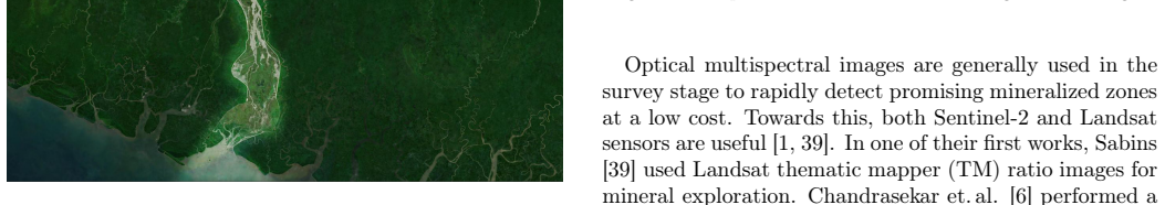
The LAMES dataset supplies annotated satellite data for 150 large-scale mining sites and 870 square kilometers of artisanal small-scale mining areas together with site metadata.
A machine-rendered reading of the paper's core claim, the machinery that carries it, and where it could break.
Core claim
The paper establishes a publicly usable collection of 150 large-scale mining sites and 870 km² of manually segmented artisanal small-scale mining areas, each large-scale site accompanied by nine section labels and 27 attribute fields, intended as ground truth for segmentation algorithms that monitor mining-related land cover change.
What carries the argument
The LAMES dataset, which consists of satellite imagery with pixel-level segmentation masks for mining sites plus structured metadata on site sections and attributes.
If this is right
- Segmentation models trained on the data can locate and measure the spatial footprint of both legal and illegal mining operations.
- Attribute labels allow studies that link specific mine characteristics such as processing methods to observable environmental effects like deforestation or erosion.
- The dataset supports repeated monitoring of the same sites over time to quantify land-use expansion.
- Release of the data lowers the barrier for researchers studying mining impacts in data-scarce regions.
- The accompanying ethics discussion highlights responsibilities when such monitoring data is used for enforcement or policy.
Where Pith is reading between the lines
- The labels could be combined with time-series imagery to create change-detection benchmarks for mining activity.
- Similar annotation efforts in other countries with artisanal mining could test whether the same attribute schema transfers without modification.
- Automated models built from this data might eventually flag previously undocumented sites for further investigation.
- The dataset size and diversity provide a concrete test bed for comparing different remote-sensing segmentation architectures on the same real-world task.
Load-bearing premise
The manual annotations are accurate and complete enough to serve as reliable ground truth for training and evaluating segmentation models.
What would settle it
An independent field survey or higher-resolution imagery comparison that shows the provided segmentation boundaries deviate substantially from actual mine extents on the ground.
Figures


read the original abstract
Mining operations are of utmost importance to the economy of some nations. However, such operations result in land-use change, very high energy consumption, and negative impacts on the environment, including soil erosion and deforestation. The mining process can impact an area much larger than the mining site itself. Adding to the negative externalities linked to mining is the fact that, in addition to government-sanctioned legal mining operations, illegal mining is widespread, including in various countries of Africa. The ability to monitor remote mining site activities can be useful, e.g., for the detection of illegal artisanal mining activities and their environmental impacts. An important outcome of such monitoring could include a better understanding of the interrelationship between mine facility attributes (e.g., mining types, processing methods, commodities, etc.) and their impact on the natural environment. In this work, we present a data set that contains 150 Large Scale Mining (LSM) sites and 870km^2 annotated area of Artisanal Small-scale Mining (ASM) sites. The metadata includes nine eminent LSM sections and 27 mining site attributes for each LSM site. We also discuss the data set's possible contribution to the research community, social and environmental consequences, and researchers' responsibilities from an ethics perspective.
Editorial analysis
A structured set of objections, weighed in public.
Referee Report
Summary. The manuscript introduces the LAMES dataset, which comprises 150 large-scale mining (LSM) sites with metadata (nine eminent sections and 27 attributes per site) and 870 km² of manually annotated artisanal small-scale mining (ASM) sites intended for semantic segmentation to monitor environmental impacts, land-use change, and illegal mining activities.
Significance. If the annotations are reliable, the dataset would provide a valuable resource for training and benchmarking segmentation models in remote sensing, particularly for understudied ASM sites in Africa. It enables linking site attributes to environmental outcomes and supports applications in policy, conservation, and illegal activity detection. The inclusion of both LSM metadata and large-scale ASM masks, plus an ethics discussion, strengthens its potential contribution.
major comments (2)
- [Abstract and Dataset Description] Abstract and dataset description: the central claim is the release of a usable segmentation dataset, yet no information is provided on the annotation protocol, tools, annotator training, number of annotators, inter-annotator agreement, boundary ambiguity handling for ASM sites, or validation against independent sources. This directly affects whether the 870 km² ASM masks can serve as reliable ground truth.
- [Dataset Description] Dataset section: without details on quality control or reproducibility of the manual annotations, downstream users cannot assess label accuracy or extend the dataset, undermining the paper's utility as a benchmark resource.
minor comments (3)
- [Abstract] The abstract could specify the satellite imagery sources, spatial resolution, and geographic regions covered to better contextualize the data.
- Add explicit licensing terms, access instructions, and a data availability statement to facilitate adoption by the research community.
- [Ethics Discussion] The ethics section would benefit from references to existing guidelines on remote sensing datasets involving sensitive environmental or illegal activity monitoring.
Simulated Author's Rebuttal
We thank the referee for the constructive feedback and the recommendation for major revision. The comments correctly identify that additional details on the annotation process are needed to strengthen the manuscript's claim that the ASM masks constitute reliable ground truth for segmentation tasks. We address each point below and will revise the manuscript accordingly to improve transparency and reproducibility.
read point-by-point responses
-
Referee: [Abstract and Dataset Description] Abstract and dataset description: the central claim is the release of a usable segmentation dataset, yet no information is provided on the annotation protocol, tools, annotator training, number of annotators, inter-annotator agreement, boundary ambiguity handling for ASM sites, or validation against independent sources. This directly affects whether the 870 km² ASM masks can serve as reliable ground truth.
Authors: We agree that these specifics are essential for users to judge label quality. In the revised manuscript we will add a dedicated 'Annotation Protocol' subsection under Dataset Description. It will specify the GIS tools employed, the number of annotators and their training (including reference imagery and guidelines for ASM features), the procedure for resolving boundary ambiguities (e.g., expert consensus on transitional zones), and any internal validation steps performed. We will also state that formal inter-annotator agreement was not computed because annotations were produced by a single primary annotator followed by expert review; this limitation will be noted explicitly rather than claimed otherwise. Any cross-checks against independent sources will be described or acknowledged as absent. revision: yes
-
Referee: [Dataset Description] Dataset section: without details on quality control or reproducibility of the manual annotations, downstream users cannot assess label accuracy or extend the dataset, undermining the paper's utility as a benchmark resource.
Authors: We accept this assessment. The revised Dataset section will include a new 'Quality Control and Reproducibility' paragraph that outlines the quality-control workflow (iterative review, use of high-resolution reference layers, and consistency checks), the annotation guidelines that will be released as supplementary material, and any steps taken to support future extension by other researchers. These additions will directly address the referee's concern about assessability and extensibility. revision: yes
Circularity Check
Dataset release paper contains no derivations or predictions
full rationale
The paper is a data-release description presenting 150 LSM sites and 870 km² of ASM annotations along with metadata attributes. It includes no equations, no fitted parameters, no predictions, and no derivation chain that could reduce to inputs by construction. No self-citations are invoked as load-bearing uniqueness theorems or ansatzes. The work is self-contained as an empirical dataset contribution without any mathematical or predictive structure that requires circularity analysis.
Axiom & Free-Parameter Ledger
Lean theorems connected to this paper
-
IndisputableMonolith/Foundation/RealityFromDistinction.leanreality_from_one_distinction unclear?
unclearRelation between the paper passage and the cited Recognition theorem.
We present a data set that contains 150 Large Scale Mining (LSM) sites and 870 km² annotated area of Artisanal Small-scale Mining (ASM) sites... prepared masks for segmentation tasks
-
IndisputableMonolith/Cost/FunctionalEquation.leanwashburn_uniqueness_aczel unclear?
unclearRelation between the paper passage and the cited Recognition theorem.
U-Net architecture incorporating a ResNet-50 backbone... cross-entropy loss... class-specific pixel weighting
What do these tags mean?
- matches
- The paper's claim is directly supported by a theorem in the formal canon.
- supports
- The theorem supports part of the paper's argument, but the paper may add assumptions or extra steps.
- extends
- The paper goes beyond the formal theorem; the theorem is a base layer rather than the whole result.
- uses
- The paper appears to rely on the theorem as machinery.
- contradicts
- The paper's claim conflicts with a theorem or certificate in the canon.
- unclear
- Pith found a possible connection, but the passage is too broad, indirect, or ambiguous to say the theorem truly supports the claim.
Reference graph
Works this paper leans on
-
[1]
Adiri, Z., Lhissou, R., El Harti, A., Jellouli, A., and Chakouri, M.: Recent advances in the use of public domain satellite imagery for mineral exploration: A review of Landsat-8 and Sentinel-2 applications, Ore Geology Reviews, 117, 103332, 2020
work page 2020
-
[2]
Alonzo, M., Van Den Hoek, J., and Ahmed, N.: Cap- turing coupled riparian and coastal disturbance from industrial mining using cloud-resilient satellite time series analysis, Scientific Reports, 6, 1–12, 2016
work page 2016
-
[3]
Balaniuk, R., Isupova, O., and Reece, S.: Mining and tailings dam detection in satellite imagery using deep learning, Sensors, 20, 6936, 2020
work page 2020
-
[4]
Bian, Z., Inyang, H. I., Daniels, J. L., Otto, F., and Struthers, S.: Environmental issues from coal mining and their solutions, Mining Science and Technology (China), 20, 215 – 223, https://doi.org/https://doi.org/10.1016/S1674- 5264(09)60187-3, 2010
-
[5]
Bishop, C. A., Liu, J. G., and Mason, P. J.: Hyper- spectral remote sensing for mineral exploration in Pu- lang, Yunnan Province, China, International Journal of Remote Sensing, 32, 2409–2426, 2011
work page 2011
-
[6]
Chandrasekar, N., Mujabar, P. S., and Rajaman- ickam, G.: Investigation of heavy-mineral deposits us- ing multispectral satellite data, International journal of remote sensing, 32, 8641–8655, 2011
work page 2011
-
[7]
Chen, W., Li, X., and Wang, L.: Fine land cover clas- sification in an open pit mining area using optimized support vector machine and worldview-3 imagery, Re- mote Sensing, 12, 82, 2020. 12
work page 2020
-
[8]
Chenwi, L.: African Commission reaffirms protection of socio-economic rights in the African Charter, ESR Review: Economic and Social Rights in South Africa, 11, 10–12, 2010
work page 2010
-
[9]
Cleverley, P. H.: Ethical recommendations for Artifi- cialIntelligencetechnologyintheGeologicalSciences- with a focus on Language Models, Journal of Geoethics and Social Geosciences, 1, 2024
work page 2024
-
[10]
de la Vergne, J.: Hard Rock Miner’s Handbook, McIntosh Engineering, 2008
work page 2008
- [11]
-
[12]
Diehl, E., Sanhudo, C. E. D., and Diehl-Fleig, E.: Ground-dwelling ant fauna of sites with high levels of copper, Brazilian Journal of Biology, 64, 33 – 39, 2004
work page 2004
-
[13]
Dozolme, P.: Learn What Illegal Mining Operations Are., thoughtco.com/what-is-illegal-mining-and-how- significant-is-it-2367443, 2020
work page 2020
-
[14]
Earth, N.: 1:110m Cultural Vectors - Admin 0 Coun- tries, accessed: 2024-06-15, 2024
work page 2024
-
[15]
Ge, W., Cheng, Q., Jing, L., Wang, F., Zhao, M., and Ding, H.: Assessment of the Capability of Sentinel-2 Imagery for Iron-Bearing Minerals Mapping: A Case Study in the Cuprite Area, Nevada, Remote Sensing, 12, 3028, 2020
work page 2020
-
[16]
Haddaway, N.R., Cooke, S.J., Lesser, P., Macura, B., Nilsson, A. E., Taylor, J. J., and Raito, K.: Evidence of the impacts of metal mining and the effectiveness of mining mitigation measures on social–ecological sys- tems in Arctic and boreal regions: a systematic map protocol, Environmental evidence, 8, 1–11, 2019
work page 2019
-
[17]
Deep residual learning for image recognition,
He, K., Zhang, X., Ren, S., and Sun, J.: Deep Residual Learning for Image Recognition, in: 2016 IEEE Conference on Computer Vision and Pattern Recognition (CVPR), pp. 770–778, https://doi.org/ 10.1109/CVPR.2016.90, 2016
-
[18]
Huo, H., Jiang, X., Song, X., Li, Z.-L., Ni, Z., and Gao, C.: Detection of coal fire dynamics and propa- gation direction from multi-temporal nighttime Land- sat SWIR and TIR data: A case study on the Rujigou coalfield, Northwest (NW) China, Remote sensing, 6, 1234–1259, 2014
work page 2014
-
[19]
Isidro, C. M., McIntyre, N., Lechner, A. M., and Cal- low, I.: Applicability of earth observation for identi- fying small-scale mining footprints in a wet tropical region, Remote Sensing, 9, 945, 2017
work page 2017
-
[20]
Kahl, M.: LAMES (Revision 60cb952), https://doi.org/10.57967/hf/7223, 2025
-
[21]
Kahl, M.: LAMES_metadata (Revision fce70ef), https://doi.org/10.57967/hf/7289, 2025
-
[22]
Kochupillai, M., Kahl, M., Schmitt, M., Taubenböck, H., and Zhu, X. X.: Earth Observation and Arti- ficial Intelligence: Understanding emerging ethical issues and opportunities, IEEE Geoscience and Re- mote Sensing Magazine, 10, 90–124, https://doi.org/ 10.1109/MGRS.2022.3208357, 2022
-
[23]
Liu, D., She, D., Yu, S., Shao, G., and Chen, D.: Rainfall intensity and slope gra- dient effects on sediment losses and splash from a saline–sodic soil under coastal reclama- tion, CATENA, 128, 54 – 62, https://doi.org/ https://doi.org/10.1016/j.catena.2015.01.022, 2015
-
[24]
Lobo, F., Souza-Filho, P., Novo, E., Carlos, F., and Barbosa, C.: Mapping mining areas in the brazilian amazon using msi/sentinel-2 imagery (2017), Remote Sensing, 10, 1178, 2018
work page 2017
-
[25]
Lobo, F. L., Costa, M. P., and Novo, E. M.: Time- series analysis of Landsat-MSS/TM/OLI images over Amazonian waters impacted by gold mining activi- ties, Remote Sensing of Environment, 157, 170–184, 2015
work page 2015
-
[26]
Luethje, F., Kranz, O., and Schoepfer, E.: Ge- ographic object-based image analysis using optical satellite imagery and GIS data for the detection of mining sites in the Democratic Republic of the Congo, Remote Sensing, 6, 6636–6661, 2014
work page 2014
-
[27]
Maest, A., Kuipers, J., MacHardy, K., and Law- son, G.: PREDICTED VERSUS ACTUAL WA- TERQUALITYATHARDROCKMINESITES:EF- FECT OF INHERENT GEOCHEMICAL AND HY- DROLOGIC CHARACTERISTICS, in: Poster paper presented at the 7 th International conference on acid rock drainage, 2006
work page 2006
-
[28]
O.: Spectral Indices for Detecting Change Trend in Vegetation affected by Hydrocarbon Spillage, 2015
Makinde, E. O.: Spectral Indices for Detecting Change Trend in Vegetation affected by Hydrocarbon Spillage, 2015
work page 2015
-
[29]
Maus, V., Giljum, S., Gutschlhofer, J., da Silva, D. M., Probst, M., Gass, S. L. B., Luck- eneder, S., Lieber, M., and McCallum, I.: Global- scale mining polygons (Version 1), https://doi.org/ 10.1594/PANGAEA.910894, 2020
-
[30]
Mielke, C., Bösche, N. K., Rogass, C., Segl, K., Gauert, C., and Kaufmann, H.: Potential applica- tions of the Sentinel-2 multispectral sensor and the EnMap hyperspectral sensor in mineral exploration, in: EARSeL EProceedings, vol. 13, pp. 93–102, 2014. 13
work page 2014
-
[31]
Mishra, R. K., Bahuguna, P., and Singh, V.: De- tection of coal mine fire in Jharia Coal Field using Landsat-7 ETM+ data, International journal of coal geology, 86, 73–78, 2011
work page 2011
-
[32]
"Perlez, J. and Bonner, R.: "Below a Mountain of Wealth, a River of Waste.", "The New York Times", "2017"
work page 2017
-
[33]
Petropoulos, G. P., Partsinevelos, P., and Mitraka, Z.: Change detection of surface mining activity and reclamation based on a machine learning approach of multi-temporal Landsat TM imagery, Geocarto Inter- national, 28, 323–342, 2013
work page 2013
-
[34]
Pour, A. B. and Hashim, M.: ASTER, ALI and Hy- perion sensors data for lithological mapping and ore minerals exploration, SpringerPlus, 3, 1–19, 2014
work page 2014
-
[35]
Pour, A. B., Hashim, M., and Marghany, M.: Explo- ration of gold mineralization in a tropical region using Earth Observing-1 (EO1) and JERS-1 SAR data: a case study from Bau gold field, Sarawak, Malaysia, Arabian Journal of Geosciences, 7, 2393–2406, 2014
work page 2014
-
[36]
Price, W. A. and Tremblay, G. A.: An overview of acid mine drainage mitigation and test work in northwest Quebec, https://doi.org/ http://dx.doi.org/10.14288/1.0042222, 1993
-
[37]
Ronneberger, O., Fischer, P., and Brox, T.: U- Net: Convolutional Networks for Biomedical Im- age Segmentation, in: Medical Image Computing and Computer-Assisted Intervention – MICCAI 2015, edited by Navab, N., Hornegger, J., Wells, W. M., and Frangi, A.F., pp. 234–241, Springer International Publishing, ISBN 978-3-319-24574-4, 2015
work page 2015
-
[38]
Rudorff, N., Rudorff, C. M., Kampel, M., and Ortiz, G.: Remote sensing monitoring of the impact of a major mining wastewater disaster on the turbidity of the Doce River plume off the eastern Brazilian coast, ISPRS Journal of Photogrammetry and Remote Sens- ing, 145, 349–361, 2018
work page 2018
-
[39]
Sabins, F.F.: Remotesensingformineralexploration, Ore geology reviews, 14, 157–183, 1999
work page 1999
-
[40]
Schmidt, H. and Glaesser, C.: Multitemporal analysis of satellite data and their use in the monitoring of the environmental impacts of open cast lignite mining areas in Eastern Germany, International Journal of Remote Sensing, 19, 2245–2260, 1998
work page 1998
-
[41]
Schoepfer, E., Kranz, O., Addink, E., and Coillie, F.: Monitoring natural resources in conflict using an object-based multi-scale image analysis approach, Proceedings of GEOBIA, 2010
work page 2010
-
[42]
Sekandari, M., Masoumi, I., Beiranvand Pour, A., M Muslim, A., Rahmani, O., Hashim, M., Zo- heir, B., Pradhan, B., Misra, A., and Aminpour, S. M.: Application of Landsat-8, Sentinel-2, ASTER and WorldView-3 spectral imagery for exploration of carbonate-hosted Pb-Zn deposits in the Central Ira- nian Terrane (CIT), Remote Sensing, 12, 1239, 2020
work page 2020
-
[43]
Service, G. S.: 2000 Population and Housing Census: Special Report on Urban Localities, Statistical Ser- vice, 2002
work page 2000
-
[44]
Spoto, F., Sy, O., Laberinti, P., Martimort, P., Fer- nandez, V., Colin, O., Hoersch, B., and Meygret, A.: Overview of sentinel-2, in: 2012 IEEE international geoscience and remote sensing symposium, pp. 1707– 1710, IEEE, 2012
work page 2012
-
[45]
L., Renne, E., Roncoli, C., Agyei- Baffour, P., and Tenkorang, E
Wilson, M. L., Renne, E., Roncoli, C., Agyei- Baffour, P., and Tenkorang, E. Y.: Integrated As- sessment of Artisanal and Small-Scale Gold Mining in Ghana — Part 3: Social Sciences and Economics, International Journal of Environmental Research and Public Health, 12, 8133–8156, https://doi.org/ 10.3390/ijerph120708133, 2015
-
[46]
Xia, L., HU, Z.-q., LIU, W.-j., and HUANG, X.-y.: Vegetation Growth Monitoring Under Coal Exploita- tion Stress by Remote Sensing in the Bulianta Coal Mining Area, Journal of China University of Mining and Technology, 17, 479–483, 2007
work page 2007
-
[47]
Yuan, W., Wang, Q., Fan, J., and Li, H.: MIN- ING LAND SUBSIDENCE MONITORING US- ING SENTINEL-1 SAR DATA., ISPRS-International Archives of the Photogrammetry, Remote Sensing and Spatial Information Sciences, pp. 655–658, 2017
work page 2017
-
[48]
Zadeh, M. H., Tangestani, M. H., Roldan, F. V., and Yusta, I.: Sub-pixel mineral mapping of a porphyry copper belt using EO-1 Hyperion data, Advances in Space Research, 53, 440–451, 2014
work page 2014
-
[49]
Zoheir, B. and Emam, A.: Integrating geologic and satellite imagery data for high-resolution mapping and gold exploration targets in the South Eastern Desert, Egypt, Journal of African Earth Sciences, 66, 22–34, 2012
work page 2012
-
[50]
Zoheir, B., El-Wahed, M. A., Pour, A. B., and Ab- delnasser, A.: Orogenic gold in transpression and transtension zones: Field and remote sensing stud- ies of the barramiya–mueilha sector, Egypt, Remote Sensing, 11, 2122, 2019
work page 2019
-
[51]
Zoheir, B., Emam, A., Abdel-Wahed, M., and Soli- man, N.: Multispectral and radar data for the setting of gold mineralization in the South Eastern Desert, Egypt, Remote Sensing, 11, 1450, 2019. 14
work page 2019
discussion (0)
Sign in with ORCID, Apple, or X to comment. Anyone can read and Pith papers without signing in.