CLIP the Landscape: Automated Tagging of Crowdsourced Landscape Images
Pith reviewed 2026-05-19 08:58 UTC · model grok-4.3
The pith
Combining location and title embeddings with image features improves exact-match accuracy on tagging landscape photos with 49 geographical context labels.
A machine-rendered reading of the paper's core claim, the machinery that carries it, and where it could break.
Core claim
The authors establish that a multi-modal setup fusing CLIP-derived image embeddings with separate embeddings for photo location and title produces higher exact-match accuracy on the 49-tag multi-label task than image embeddings alone, while remaining computationally light enough to train on ordinary hardware.
What carries the argument
Multi-modal fusion of CLIP image embeddings with location and title text embeddings passed through a classification head for multi-label prediction of geographical context tags.
If this is right
- Tags generated this way can serve as input to build location embedders for GeoAI applications.
- The approach can enrich spatial understanding in regions that lack points of interest or street-level imagery.
- A lightweight training pipeline using frozen CLIP embeddings makes the method accessible without heavy compute.
- The released code allows direct application to the broader Geograph archive beyond the Kaggle subset.
Where Pith is reading between the lines
- Similar multi-modal tagging could extend to other large crowdsourced photo collections that pair images with location metadata.
- Adding time-of-day or weather embeddings might further refine tag predictions in variable landscapes.
- The tags could help bootstrap training data for models that infer location purely from visual cues in data-sparse zones.
Load-bearing premise
The Kaggle competition subset of Geograph images is representative enough that accuracy gains will hold for the full eight million images or for landscape photos outside the British Isles.
What would settle it
Running the same multi-modal versus image-only comparison on the full remaining Geograph collection or on an equivalent set of landscape photos from a non-British region and finding that the accuracy lift disappears.
Figures


read the original abstract
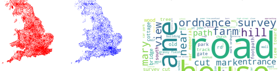
We present a CLIP-based, multi-modal, multi-label classifier for predicting geographical context tags from landscape photos in the Geograph dataset--a crowdsourced image archive spanning the British Isles, including remote regions lacking POIs and street-level imagery. Our approach addresses a Kaggle competition\footnote{https://www.kaggle.com/competitions/predict-geographic-context-from-landscape-photos} task based on a subset of Geograph's 8M images, with strict evaluation: exact match accuracy is required across 49 possible tags. We show that combining location and title embeddings with image features improves accuracy over using image embeddings alone. We release a lightweight pipeline\footnote{https://github.com/SpaceTimeLab/ClipTheLandscape} that trains on a modest laptop, using pre-trained CLIP image and text embeddings and a simple classification head. Predicted tags can support downstream tasks such as building location embedders for GeoAI applications, enriching spatial understanding in data-sparse regions.
Editorial analysis
A structured set of objections, weighed in public.
Referee Report
Summary. The manuscript presents a CLIP-based multi-modal multi-label classifier for assigning one of 49 geographical context tags to landscape images from the Geograph crowdsourced dataset. The central empirical claim is that fusing pre-trained location and title embeddings with CLIP image features produces higher exact-match accuracy than image features alone on the Kaggle competition subset; a lightweight training pipeline using a simple classification head on frozen embeddings is released for reproducibility.
Significance. If the reported accuracy gains are robust and clearly quantified, the work offers a practical, low-resource method for enriching metadata in large-scale crowdsourced geo-image archives, especially in remote areas without POI or street-level coverage. The explicit release of the training pipeline is a strength that supports reproducibility and downstream use in GeoAI tasks.
major comments (1)
- Results section: The central claim of accuracy improvement from multi-modal fusion requires explicit reporting of the exact-match accuracy values for the image-only baseline versus the combined model, together with any standard deviations, number of runs, or statistical tests; without these numbers the magnitude and reliability of the gain cannot be assessed from the text alone.
minor comments (3)
- Abstract: The footnote referencing the Kaggle competition would benefit from a brief parenthetical note on the exact evaluation protocol (exact-match across 49 tags) to make the task constraints immediately clear to readers.
- Methods: The description of how the three embedding streams are fused before the classification head (concatenation, weighted sum, etc.) should be stated explicitly, even if the implementation is simple, to aid exact reproduction.
- Discussion: The limitation that results are obtained on a British-Isles Kaggle subset and may not generalize to the full 8 M images or non-UK regions is mentioned but could be expanded with a short forward-looking sentence on planned validation.
Simulated Author's Rebuttal
We thank the referee for the constructive feedback and the recommendation for minor revision. We address the single major comment below and will incorporate the requested details into the revised manuscript.
read point-by-point responses
-
Referee: Results section: The central claim of accuracy improvement from multi-modal fusion requires explicit reporting of the exact-match accuracy values for the image-only baseline versus the combined model, together with any standard deviations, number of runs, or statistical tests; without these numbers the magnitude and reliability of the gain cannot be assessed from the text alone.
Authors: We agree that the specific numerical values should be stated explicitly to allow readers to assess the magnitude of the improvement. The current manuscript states that multi-modal fusion improves accuracy over image embeddings alone but does not report the precise exact-match percentages in the main text. In the revised version we will add these values directly in the Results section (or in a new table) for both the image-only baseline and the location+title+image model. Because the CLIP embeddings are frozen and the classification head is a simple linear layer trained to convergence on a fixed dataset split, each configuration was run once; we will note this explicitly and will not report standard deviations or statistical tests, as no repeated trials were performed. revision: yes
Circularity Check
No significant circularity in empirical evaluation of multi-modal fusion
full rationale
The manuscript reports an empirical ML experiment: pre-trained CLIP image and text embeddings are extracted, concatenated with location/title features, and passed through a simple trainable classification head to predict 49 tags on the Kaggle Geograph subset. The claimed accuracy improvement is measured directly on held-out competition data via standard train/validation splits and exact-match metric. No derivation chain, equations, or fitted parameters are presented that reduce the reported result to the inputs by construction; the pipeline is released for external reproduction. The work is therefore self-contained against the external Kaggle benchmark and does not rely on self-citation load-bearing premises or ansatz smuggling.
Axiom & Free-Parameter Ledger
axioms (1)
- domain assumption Pre-trained CLIP embeddings transfer effectively to geographical context tagging without domain-specific fine-tuning of the backbone.
Lean theorems connected to this paper
-
IndisputableMonolith/Cost/FunctionalEquation.leanwashburn_uniqueness_aczel unclear?
unclearRelation between the paper passage and the cited Recognition theorem.
We employ CLIP [12], a vision-language model... freeze both encoders and use their pre-trained weights... multimodal fusion... linear layer and a multi-layer perceptron (MLP)
-
IndisputableMonolith/Foundation/AlexanderDuality.leanalexander_duality_circle_linking unclear?
unclearRelation between the paper passage and the cited Recognition theorem.
exact match accuracy is required across 49 possible tags... combining location and title embeddings with image features improves accuracy
What do these tags mean?
- matches
- The paper's claim is directly supported by a theorem in the formal canon.
- supports
- The theorem supports part of the paper's argument, but the paper may add assumptions or extra steps.
- extends
- The paper goes beyond the formal theorem; the theorem is a base layer rather than the whole result.
- uses
- The paper appears to rely on the theorem as machinery.
- contradicts
- The paper's claim conflicts with a theorem or certificate in the canon.
- unclear
- Pith found a possible connection, but the passage is too broad, indirect, or ambiguous to say the theorem truly supports the claim.
Reference graph
Works this paper leans on
-
[1]
Aitor Àvila Callau, María Yolanda Pérez Albert, Joan Jurado Rota, and David Ser- rano Giné. 2019. Landscape characterization using photographs from crowd- sourced platforms: content analysis of social media photographs. Open Geo- sciences 11, 1 (Jan. 2019), 558–571. https://doi.org/10.1515/geo-2019-0046
-
[2]
Weiming Huang, Wang , Jing, , and Gao Cong. 2024. Zero-shot urban function in- ference with street view images through prompting a pretrained vision-language model. International Journal of Geographical Information Science 38, 7 (July 2024), 1414–1442. https://doi.org/10.1080/13658816.2024.2347322
-
[3]
Barry Hunter. 2024. Predict Geographic Context from Landscape Photos. https://kaggle.com/competitions/predict-geographic-context-from- landscape-photos. Kaggle
work page 2024
-
[4]
Ilya Ilyankou, Aldo Lipani, Stefano Cavazzi, Xiaowei Gao, and James Haworth
-
[5]
Do Sentence Transformers Learn Quasi-Geospatial Concepts from General Text? GeoExT 2024: Second International Workshop on Geographic Information Extraction from Texts at ECIR 2024, March 24, 2024, Glasgow, Scotland (2024)
work page 2024
-
[6]
Natchapon Jongwiriyanurak, Zichao Zeng, June Moh Goo, James Haworth, Xinglei Wang, Kerkritt Sriroongvikrai, Nicola Christie, Ilya Ilyankou, Meihui Wang, and Huanfa Chen. 2025. V-RoAst: Visual Road Assessment. Can VLM be a Road Safety Assessor Using the iRAP Standard? arXiv:2408.10872 [cs.CV]
work page internal anchor Pith review Pith/arXiv arXiv 2025
-
[7]
Natchapon Jongwiriyanurak, Zichao Zeng, Meihui Wang, James Haworth, Gar- avig Tanaksaranond, and Jan Boehm. 2023. Framework for Motorcycle Risk Assessment Using Onboard Panoramic Camera. In 12th International Conference on Geographic Information Science (GIScience 2023)
work page 2023
- [8]
-
[9]
Xiang Li, Congcong Wen, Yuan Hu, and Nan Zhou. 2023. RS-CLIP: Zero shot remote sensing scene classification via contrastive vision-language supervision. International Journal of Applied Earth Observation and Geoinformation 124 (Nov. 2023), 103497. https://doi.org/10.1016/j.jag.2023.103497
-
[10]
Jianzhe Lin, Tianze Yu, and Z. Jane Wang. 2022. Rethinking Crowdsourcing Annotation: Partial Annotation With Salient Labels for Multilabel Aerial Image Classification. IEEE Transactions on Geoscience and Remote Sensing 60 (2022), 1–12. https://doi.org/10.1109/TGRS.2022.3191735
-
[11]
Xinyi Liu, James Haworth, and Meihui Wang. 2023. A New Approach to Assess- ing Perceived Walkability: Combining Street View Imagery with Multimodal Contrastive Learning Model. In Proceedings of the 2nd ACM SIGSPATIAL Inter- national Workshop on Spatial Big Data and AI for Industrial Applications . ACM, Hamburg Germany, 16–21. https://doi.org/10.1145/36158...
-
[12]
Maxime Oquab, Timothée Darcet, Théo Moutakanni, Huy Vo, Marc Szafraniec, Vasil Khalidov, Pierre Fernandez, Daniel Haziza, Francisco Massa, Alaaeldin El-Nouby, Mahmoud Assran, Nicolas Ballas, Wojciech Galuba, Russell Howes, Po-Yao Huang, Shang-Wen Li, Ishan Misra, Michael Rabbat, Vasu Sharma, Gabriel Synnaeve, Hu Xu, Hervé Jegou, Julien Mairal, Patrick Lab...
work page internal anchor Pith review Pith/arXiv arXiv doi:10.48550/arxiv.2304.07193 2024
-
[13]
Alec Radford, Jong Wook Kim, Chris Hallacy, Aditya Ramesh, Gabriel Goh, Sandhini Agarwal, Girish Sastry, Amanda Askell, Pamela Mishkin, Jack Clark, Gretchen Krueger, and Ilya Sutskever. 2021. Learning Transferable Visual Models From Natural Language Supervision. https://doi.org/10.48550/arXiv.2103.00020
work page internal anchor Pith review Pith/arXiv arXiv doi:10.48550/arxiv.2103.00020 2021
-
[14]
Nils Reimers and Iryna Gurevych. 2019. Sentence-BERT: Sentence Embeddings using Siamese BERT-Networks. http://arxiv.org/abs/1908.10084
work page internal anchor Pith review Pith/arXiv arXiv 2019
-
[15]
Xinglei Wang, Tao Cheng, Stephen Law, Zichao Zeng, Lu Yin, and Junyuan Liu
-
[16]
Computers, Environment and Urban Systems 120 (Sept
Multi-modal contrastive learning of urban space representations from POI data. Computers, Environment and Urban Systems 120 (Sept. 2025), 102299. https://doi.org/10.1016/j.compenvurbsys.2025.102299
-
[17]
Xinchen Wang, Alesja Gilvear, Yijing Li, and Ilya Ilyankou. 2025. Can CLIP See Safe Streets? Comparing Human and VLM Perceptions of Walkability and Safety. Presented at the Walking the X-min City workshop, AGILE 2025, Dresden
work page 2025
-
[18]
mixup: Beyond Empirical Risk Minimization
Hongyi Zhang, Moustapha Cisse, Yann N. Dauphin, and David Lopez-Paz. 2018. mixup: Beyond Empirical Risk Minimization. https://doi.org/10.48550/arXiv. 1710.09412 arXiv:1710.09412 [cs]. Received 29 May 2025 CLIP the Landscape Group Tag Description Topography Coastal Landforms that occur where the land meets the sea. Islands Areas of land completely surround...
work page internal anchor Pith review Pith/arXiv arXiv doi:10.48550/arxiv 2018
discussion (0)
Sign in with ORCID, Apple, or X to comment. Anyone can read and Pith papers without signing in.