REVIEW 4 major objections 4 minor 48 references
Using Multiple Input Modalities Can Improve Data-Efficiency and O.O.D. Generalization for ML with Satellite Imagery
T0 review · 4 major / 4 minor · reviewed 2026-08-06 · deepseek-v4-flash
Pith's one-line read Adding simple geographic layers to satellite imagery can sharply cut the labels a model needs and lift out-of-region accuracy, across classification, segmentation, and regression tasks.
desk verdict Well-run empirical study with a useful data release and a striking frozen-vs-finetuned result, but the headline overclaims because most auxiliary inputs are near-proxies for the target. read the letter →
The pith
A machine-rendered reading of the paper's core claim, the machinery that carries it, and where it could break.
The reading
What carries the argument
The central object is the fusion mechanism that injects geographic context into the model, studied in three concrete forms. STACK simply concatenates rasterized auxiliary layers (OSM maps, EU-DEM) to the optical input channels before feeding them to a convolutional architecture. PROC-STACK applies a fixed function $f(\cdot)$—here a hand-coded prior derived from NLCD co-occurrence statistics enriched with road, building, and waterway masks—to the geographic rasters, then stacks the result with the optical input. TOKEN-FUSE appends a pretrained SatCLIP location-encoder embedding $g(\text{lat},\text{lon})$ as an auxiliary token to a Vision Transformer's token sequence, giving the model a compact, frozen summary of terrain and socioeconomic context for each tile's coordinates. The claim that hard-coded beats learned depends on these variants: the frozen prior and frozen location encoder consistently outperform their fine-tuned counterparts.
What would settle it
Measure the same fusion recipes on a task where the auxiliary layer is clearly decoupled from the label—for example, predicting building footprint from NAIP imagery but fusing only road rasters with high-density roads unrelated to building locations—and test whether the low-data gains persist; if gains vanish or turn negative, the reported improvements may be driven by target-proxy overlap rather than generic multi-modal value. A second check: rerun the BigEarthNet TOKEN-FUSE comparison with a location encoder whose pretraining corpus provably excludes the test regions, and see if the 3.1% F1 gain survives.
Extended reading notes
Core claim
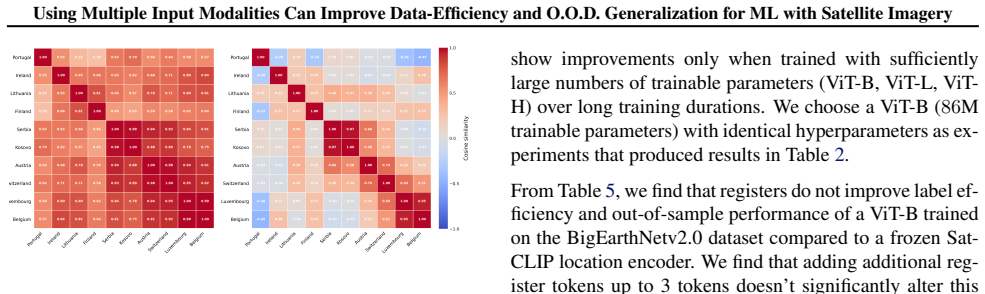
The paper's central claim is that fusing additional geographic inputs with optical imagery can significantly improve performance of machine learning models trained on satellite imagery, and that the benefit is largest exactly where SatML models struggle most: settings with limited labeled data and geographic out-of-sample test regions. Across all four benchmark datasets, augmenting the optical input with geographic layers improved results—an 8.1% Dice improvement on farmland delineation at 1–5% training data, a 9.3% accuracy improvement on EnviroAtlas land-cover segmentation at low data, a 0.162 $R^2$ improvement on tree-cover regression at 60–250 training images, and consistent improvements on BigEarthNetv2.0's spatially buffered, out-of-sample splits. The paper also establishes a surprising second claim: hard-coded fusion strategies outperform learned variants. Freezing the auxiliary geographic encoder (a hand-crafted prior in PROC-STACK, a pretrained SatCLIP location encoder in TOKEN-FUSE) preserves the gains, whereas fine-tuning those modules degrades label-efficiency and out-of-sample performance, with the fine-tuned location embeddings visibly overfitting to the training countries.
Load-bearing premise
The auxiliary geographic inputs are genuinely complementary information and not accidental proxies for the labels or the test distribution: the OSM forest classes on USA Vars overlap with the tree-cover label, the EnviroAtlas prior is built with statistics from the same land-cover domain it predicts, and the SatCLIP token's OOD benefit assumes no overlap between its pretraining corpus and the buffered BigEarthNet test tiles.
Editorial extensions
If this is right
- SatML practitioners can improve label efficiency without new architectures: appending task-relevant OSM and DEM rasters to the optical input can match baseline performance with a fraction of the training data (e.g., a U-Net matching RGB-only IoU with ~224 of 1573 images).
- Geographic auxiliary layers can serve as a cheap domain-adaptation lever for cross-region deployment, with OOD gains persisting even at 100% training data on EnviroAtlas rather than vanishing as label count grows.
- Freezing the geographic module is the safer default: hard-coded or pretrained-frozen fusion preserves gains, while fine-tuning the location encoder or a learned compression module can overfit to training regions and hurt OOD accuracy.
- The benefit is not automatic for every layer: the paper finds that some inputs (e.g., a road map for some tasks, a single DEM band on SustainBench) can hurt, so the choice of auxiliary layer and its task relevance is itself a design decision.
- The released augmented datasets and embeddings let other researchers reproduce and build on the fusion recipes without redoing the georeferencing work.
Reading between the lines
- The findings suggest a practical design rule beyond the paper's three tasks: when a task's label correlates with stable geographic structure (land cover, roads, terrain), a frozen geographic prior should be tried before any learned auxiliary module, because the paper's results indicate that the prior already encodes the transferable signal and fine-tuning mainly lets the model memorize training-re
- A testable extension would be to vary the strength of the frozen prior—e.g., perturbing or masking individual OSM classes—to measure which auxiliary channels carry the OOD gain; the paper's road-map counterexample indicates the mechanism is selective, not uniform.
- The BigEarthNet result with SatCLIP tokens likely depends on the spatial buffering of the test split; a direct check would be to compare the same TOKEN-FUSE setup on a random-split version of BigEarthNet, where the auxiliary location token would encode less new information and the gain should shrink.
- The frozen-vs-finetuned finding could generalize to other pretrained geographic embeddings (e.g., newer location encoders mentioned in the field), but the paper only tests SatCLIP, so the relative benefit of frozen priors for other encoders remains an open empirical question.
Editorial analysis
A structured set of objections, weighed in public.
Referee Report
Summary. The paper studies whether appending non-optical geographic input layers to optical satellite imagery improves label efficiency and out-of-distribution (OOD) generalization in supervised SatML. It introduces three fusion mechanisms (STACK, PROC-STACK, TOKEN-FUSE) and evaluates them on four benchmarks: SustainBench farmland delineation, EnviroAtlas land-cover segmentation, USA Vars tree-cover regression, and BigEarthNetv2.0 multi-label classification. The central claim is that auxiliary geographic inputs improve performance, with the largest gains in low-label and OOD settings, and that freezing the auxiliary modules (hard-coded fusion) generally outperforms learned variants. The paper contributes modified datasets, a hosted data release, and code.
Significance. If the result holds, it would give practitioners a practical and cheap recipe: append task-relevant, frozen geographic layers to optical models to improve data efficiency and geographic generalization, while avoiding fine-tuning of auxiliary encoders. The paper has several strengths: it evaluates across four diverse tasks and multiple architectures; it reports multi-seed results; it includes negative results (road maps and DEM-only often hurt); and it releases code and data products. However, the generalizability of the central claim is compromised by the fact that in three of the four benchmarks the auxiliary input is a near-proxy of the target label or is derived from labeled data, so the observed gains may not reflect a general benefit of non-optical geographic fusion. The significance is therefore conditional: the evidence supports a narrower claim about task-proxy priors unless the proxy concerns are addressed.
major comments (4)
- [§3.1, Figure 9, Figure 3, §4.1] The USA Vars tree-cover regression uses OSM raster layers that include forest and vegetation land-cover classes, which are essentially the regression target. The reported label-efficiency improvement of 0.162 in R² at 60–250 training samples is therefore plausibly explained by the auxiliary input directly encoding the label rather than by a general benefit of multi-modal fusion. The authors should either remove or ablate the forest-related classes, quantify the correlation between the OSM classes and the tree-cover label, or demonstrate gains using a non-proxy auxiliary layer (e.g., roads, buildings, or climate).
- [Appendix A.1, §4.2, Table 3] The EnviroAtlas prior is constructed by estimating P(ℓ|c) from held-out Pittsburgh high-resolution labels conditioned on NLCD 30 m classes, then applying it to OOD cities Austin and Durham. This is a label-derived statistical prior, so the reported 4.12% OOD accuracy improvement is expected if the co-occurrence statistics transfer across cities; it is not evidence that fusing auxiliary geographic inputs improves learning from optical imagery. In addition, the Austin 1% result in Table 3 (0.53±0.03 vs 0.58±0.03) has overlapping error bars, and the low-data OOD gains therefore need a formal significance test or a larger number of seeds.
- [§4.2, §3.3, Table 2] The BigEarthNet OOD claim assumes that SatCLIP's pretraining corpus does not overlap the spatially buffered validation and test splits. This assumption is not verified. Since SatCLIP is pretrained on global Sentinel-2 imagery, it likely includes patches from the same European regions that appear in the BigEarthNet test splits; if so, the frozen location token can carry test-distribution information, and the OOD gains in Table 2 would be inflated. The authors should provide an overlap check between SatCLIP pretraining locations and the BigEarthNet test tiles, or use a location encoder trained on data provably disjoint from the test regions.
- [Abstract, §4.1, §5 (Limitations)] The abstract and takeaways state that 'fusing additional geographic inputs' improves SatML performance, but the paper's own negative results (road map on EnviroAtlas, DEM-only on SustainBench) show that task-unrelated auxiliary layers often hurt. Combined with the proxy concerns above, the positive evidence is confined to inputs that directly encode the target label or the test distribution. The central claim should be scoped to task-proxy auxiliary layers, or the authors should provide a control experiment with a neutral geographic layer (e.g., population density, temperature) on at least one benchmark.
minor comments (4)
- [Table 1 caption] The caption says 'We test fusion mechanisms STACK and STACK-PROC'; this should read 'STACK and PROC-STACK' to match the notation used elsewhere.
- [Appendix A.4] The sentence describing channel normalization is ambiguous: 'the first four channels are normalized to [0,1] by division by 255, while channels 4–6 are scaled' uses overlapping channel indices; please clarify whether the OSM channels are channels 4–6 or 4–7.
- [§5 Limitations] The limitations paragraph says 'we use geographic data-layers that make sense for the downstream task'; in light of the proxy issue, the limitations should also explicitly discuss the possibility of label leakage through these task-aligned layers.
- [Appendix B, Figure 8] The text says 'These results support our observation in Figure 8' but the observation is in Figure 7 and Figure 8; please correct the cross-reference.
Circularity Check
Label-proxy auxiliary inputs in three of four benchmarks (NLCD-derived land-cover prior, OSM forest/farmland rasters) make several headline gains reduce by construction; the general multi-modal fusion claim is only partially supported.
-
self definitional
[The construction appears in Appendix A.1, 'Hand-crafted prior generation process,' and is applied to EnviroAtlas in Sections 4.1-4.2 via PROC-STACK.]
"In our PROC-STACK experiments, the hand-crafted prior f (xi) ≡ pi(ℓ) is constructed exactly as in (Rolf et al., 2022) (“Coarse data in weakly supervised segmentation”, §3), using the NLCD 30 m land-cover map to induce per-pixel beliefs over our four high-resolution classes. Concretely, we first compute the empirical co-occurrence matrix ... from a held-out set of aligned NAIP+NLCD+Land Cover tiles. Then, for each pixel i with NLCD class ci, we set pi(ℓ) = P (ℓ | ci) and apply a small Gaussian blur (σ = 1 pixel) to smooth block artifacts."
The four high-resolution classes are exactly the land-cover labels that the EnviroAtlas segmentation model is trained to predict. The auxiliary prior is therefore a per-pixel estimate of the target label distribution conditioned on NLCD, computed from labeled tiles. Feeding this as an input means the model receives a soft version of the answer before seeing the imagery; the reported 9.3% in-distribution low-data gain and 4.12% OOD gain (Figure 4, Table 3) are partly forced by this construction rather than by a general benefit of adding geographic layers. The paper's limitation statement that it uses 'geographic data-layers that make sense for the downstream task' confirms the selection is task-label-driven.
-
other
[The input selection is described in Section 3.1 (Geographic Data Fusion) and used for USA Vars tree-cover regression in Section 4.1 / Figure 3 and for SustainBench in Section 4.1 / Figure 2.]
"For the farmland-parcel delineation task with the SustainBench dataset, and the socioeconomic regression task with the USA Vars dataset, we use OSM raster layers that contain all the geographic data layers used for the EnviroAtlas dataset, with the addition of several new land-use and land-cover classes that are roughly relevant to the task. These additional raster layers include high-level biome information such as forests, wetlands, or urban-type terrain."
The USA Vars task is tree-cover regression, and the OSM rasters include a 'forests' land-cover class, which is essentially the regression target supplied as a raster input; the 0.162 R2 improvement at 60-250 training images (Figure 3) can be obtained by reading off the forest map rather than by learning from optical imagery. Similarly, SustainBench field-boundary delineation receives OSM farmland/land-use classes that approximate the target parcels. These are task-proxy inputs, not arbitrary geographic layers, so the headline claim that multi-modal inputs improve label-efficiency and OOD generalization is not established for general auxiliary modalities.
full rationale
This is an empirical benchmark study rather than a formal derivation, so the circularity is in experimental construction rather than in a proof chain. In three of four benchmarks, the auxiliary input is a near-proxy for the target label: the EnviroAtlas PROC-STACK prior is computed as a conditional distribution of the high-resolution land-cover labels given NLCD and then fed back into the same land-cover segmentation task; the USA Vars tree-cover regression uses OSM rasters containing a forests class; and SustainBench receives OSM farmland/land-use classes. The paper explicitly concedes it selected 'geographic data-layers that make sense for the downstream task.' These choices make the low-data and OOD gains in those experiments reduce, to a substantial degree, by construction. The finding that hard-coded fusion beats learned fusion is likewise confounded, because the hard-coded prior is a label-derived conditional distribution that a learned compression of raw rasters is not given. The BigEarthNet SatCLIP-token experiment is the one non-proxy auxiliary input and relies on an external pretrained location encoder; the main caveat there is an unverified assumption about SatCLIP pretraining overlap with the spatially buffered test splits, which is a data-leakage risk rather than a definitional circularity. No uniqueness theorem or load-bearing self-citation chain forces the conclusions. Score 6 reflects partial circularity: the central claim is only partially supported because the strongest supporting experiments hand the model label-derived inputs.
Assumptions & free parameters
free parameters (3)
- Prior boost weight wj =
unspecified (hand-chosen)
- OSM raster smoothing kernel sigma =
1.0
- NLCD co-occurrence matrix P(l|c) =
empirical counts on held-out Pittsburgh tiles
assumptions (4)
- domain assumption BigEarthNetv2.0 validation and test splits are geographically out-of-sample due to grid-based spatial buffering
- domain assumption SatCLIP location embeddings capture terrain, environmental, and socioeconomic signals that transfer to downstream tasks
- domain assumption NLCD co-occurrence statistics computed on Pittsburgh-area held-out tiles transfer to Austin and Durham
- domain assumption OpenStreetMap and DEM data are available and correctly aligned for all evaluated regions
Cite this review
Pith. "Pith review of Using Multiple Input Modalities Can Improve Data-Efficiency and O.O.D. Generalization for ML with Satellite Imagery." pith.science (2026). https://pith.science/paper/UUV5WTVA
@misc{pith2026250713385,
  author       = {Pith},
  title        = {Pith review of: Using Multiple Input Modalities Can Improve Data-Efficiency and O.O.D. Generalization for ML with Satellite Imagery},
  year         = {2026},
  howpublished = {\url{https://pith.science/paper/UUV5WTVA}},
  note         = {Machine review of arXiv:2507.13385}
}
read the original abstract
A large variety of geospatial data layers is available around the world ranging from remotely-sensed raster data like satellite imagery, digital elevation models, predicted land cover maps, and human-annotated data, to data derived from environmental sensors such as air temperature or wind speed data. A large majority of machine learning models trained on satellite imagery (SatML), however, are designed primarily for optical input modalities such as multi-spectral satellite imagery. To better understand the value of using other input modalities alongside optical imagery in supervised learning settings, we generate augmented versions of SatML benchmark tasks by appending additional geographic data layers to datasets spanning classification, regression, and segmentation. Using these augmented datasets, we find that fusing additional geographic inputs with optical imagery can significantly improve SatML model performance. Benefits are largest in settings where labeled data are limited and in geographic out-of-sample settings, suggesting that multi-modal inputs may be especially valuable for data-efficiency and out-of-sample performance of SatML models. Surprisingly, we find that hard-coded fusion strategies outperform learned variants, with interesting implications for future work.
Figures


Figures from the paper (5 more)


Reference graph
Works this paper leans on
-
[1]
L., Uzkent, B., Burke, M., Lobell, D., and Ermon, S
Aung, H. L., Uzkent, B., Burke, M., Lobell, D., and Ermon, S. F arm P arcel D elineation using S patio- T emporal C onvolutional N etworks. In P roceedings of the I E E E / C V F conference on computer vision and P attern R ecognition W orkshops , pp.\ 76--77, 2020
work page 2020
-
[2]
Segnet: A deep convolutional encoder–decoder architecture for image segmentation
Badrinarayanan, V., Kendall, A., and Cipolla, R. Segnet: A deep convolutional encoder–decoder architecture for image segmentation. IEEE Transactions on Pattern Analysis and Machine Intelligence, 39 0 (12): 0 2481--2495, 2017. doi:10.1109/TPAMI.2016.2644615
-
[3]
M ulti-modal learning for geospatial vegetation forecasting
Benson, V., Robin, C., Requena-Mesa, C., Alonso, L., Carvalhais, N., Cort \'e s, J., Gao, Z., Linscheid, N., Weynants, M., and Reichstein, M. M ulti-modal learning for geospatial vegetation forecasting. In P roceedings of the I E E E / C V F C onference on C omputer V ision and P attern R ecognition , pp.\ 27788--27799, 2024
work page 2024
-
[4]
Encoder-decoder with atrous separable convolution for semantic image segmentation
Chen, L.-C., Zhu, Y., Papandreou, G., Schroff, F., and Adam, H. Encoder-decoder with atrous separable convolution for semantic image segmentation. In ECCV, 2018
work page 2018
-
[5]
G eo-aware networks for fine-grained recognition
Chu, G., Potetz, B., Wang, W., Howard, A., Song, Y., Brucher, F., Leung, T., and Adam, H. G eo-aware networks for fine-grained recognition. In P roceedings of the I E E E / C V F I nternational C onference on C omputer V ision W orkshops , pp.\ 0--0, 2019
work page 2019
-
[6]
Clasen, K. N., Hackel, L. W., Burgert, T., Sumbul, G., Demir, B., and Markl, V. re BEN : R efined B ig E arth N et dataset for R emote S ensing I mage A nalysis. C o R R , abs/2407.03653, 2024. URL https://doi.org/10.48550/arXiv.2407.03653
-
[7]
S at MAE : P re-training transformers for temporal and multi-spectral satellite imagery
Cong, Y., Khanna, S., Meng, C., Liu, P., Rozi, E., He, Y., Burke, M., Lobell, D., and Ermon, S. S at MAE : P re-training transformers for temporal and multi-spectral satellite imagery. A dvances in N eural I nformation P rocessing S ystems , 35: 0 197--211, 2022
work page 2022
-
[8]
V ision T ransformers N eed R egisters
Darcet, T., Oquab, M., Mairal, J., and Bojanowski, P. V ision T ransformers N eed R egisters. In T he T welfth I nternational C onference on L earning R epresentations , 2024. URL https://openreview.net/forum?id=2dnO3LLiJ1
work page 2024
Show all 48 references
-
[9]
An image is worth 16x16 words: Transformers for image recognition at scale
Dosovitskiy, A., Beyer, L., Kolesnikov, A., Weissenborn, D., Zhai, X., Unterthiner, T., Dehghani, M., Minderer, M., Heigold, G., Gelly, S., Uszkoreit, J., and Houlsby, N. An image is worth 16x16 words: Transformers for image recognition at scale. In International Conference on...
2021 arXiv
-
[10]
Ma-net: Multi-scale attention network for liver and tumor segmentation
Fan, T., Wang, X., Cheng, M., and Tao, D. Ma-net: Multi-scale attention network for liver and tumor segmentation. IEEE Access, 8: 0 179683--179691, 2020. doi:10.1109/ACCESS.2020.3025372
2020
-
[11]
C., Patriarca, J., Jesus, I., and Duarte, D
Fonte, C. C., Patriarca, J., Jesus, I., and Duarte, D. A utomatic extraction and filtering of openstreetmap data to generate training datasets for land use land cover classification. R emote S ensing , 12 0 (20): 0 3428, 2020
2020
-
[12]
and Weber, P
Haklay, M. and Weber, P. O pen S treet M ap: U ser-generated street maps. I E E E P ervasive computing , 7 0 (4): 0 12--18, 2008
2008
-
[13]
D eep R esidual L earning for I mage R ecognition
He, K., Zhang, X., Ren, S., and Sun, J. D eep R esidual L earning for I mage R ecognition. 2016 I E E E C onference on C omputer V ision and P attern R ecognition ( C V P R ) , pp.\ 770--778, 2015. URL https://api.semanticscholar.org/CorpusID:206594692
2016
-
[14]
Continental europe digital terrain model at 30 m resolution based on gedi, icesat-2, aw3d, glo-30, eudem, merit dem and background layers
Hengl, T., Leal Parente, L., Krizan, J., and Bonannella, C. Continental europe digital terrain model at 30 m resolution based on gedi, icesat-2, aw3d, glo-30, eudem, merit dem and background layers. Version Dataset v3. 0. Zenodo, 2020
2020
-
[15]
C-unet: Complement unet for remote sensing road extraction
Hou, Y., Liu, Z., Zhang, T., and Li, Y. C-unet: Complement unet for remote sensing road extraction. Sensors, 21 0 (6): 0 2153, 2021. doi:10.3390/s21062153
2021 doi
-
[16]
V isual P rompt T uning
Jia, M., Tang, L., Chen, B.-C., Cardie, C., Belongie, S., Hariharan, B., and Lim, S.-N. V isual P rompt T uning. In E uropean C onference on C omputer V ision ( E C C V ) , 2022
2022
-
[17]
O pensentinelmap: A large-scale land use dataset using O pen S treet M ap and S entinel-2 imagery
Johnson, N., Treible, W., and Crispell, D. O pensentinelmap: A large-scale land use dataset using O pen S treet M ap and S entinel-2 imagery. In P roceedings of the I E E E / C V F C onference on C omputer V ision and P attern R ecognition , pp.\ 1333--1341, 2022
2022
-
[18]
S at CLIP : G lobal, general-purpose location embeddings with satellite imagery
Klemmer, K., Rolf, E., Robinson, C., Mackey, L., and Ru wurm, M. S at CLIP : G lobal, general-purpose location embeddings with satellite imagery. In Proceedings of the AAAI conference on artificial intelligence, 2025
2025
-
[19]
Fully convolutional networks for semantic segmentation
Long, J., Shelhamer, E., and Darrell, T. Fully convolutional networks for semantic segmentation. In Proceedings of the IEEE Conference on Computer Vision and Pattern Recognition, pp.\ 3431--3440, 2015
2015
-
[20]
P resence-only G eographical P riors for fine-grained image classification
Mac Aodha, O., Cole, E., and Perona, P. P resence-only G eographical P riors for fine-grained image classification. In P roceedings of the I E E E / C V F I nternational C onference on C omputer V ision , pp.\ 9596--9606, 2019
2019
-
[21]
C sp: S elf-supervised contrastive spatial pre-training for geospatial-visual representations
Mai, G., Lao, N., He, Y., Song, J., and Ermon, S. C sp: S elf-supervised contrastive spatial pre-training for geospatial-visual representations. In I nternational C onference on M achine L earning , pp.\ 23498--23515. PMLR, 2023
2023
-
[22]
M M E arth: E xploring multi-modal pretext tasks for geospatial representation learning
Nedungadi, V., Kariryaa, A., Oehmcke, S., Belongie, S., Igel, C., and Lang, N. M M E arth: E xploring multi-modal pretext tasks for geospatial representation learning. In European Conference on Computer Vision, pp.\ 164--182. Springer, 2024
2024
-
[23]
A utomatic conversion of O S M data into L U L C maps: comparing F O S S 4 G based approaches towards an enhanced performance
Patriarca, J., Fonte, C., Estima, J., de Almeida, J.-P., and Cardoso, A. A utomatic conversion of O S M data into L U L C maps: comparing F O S S 4 G based approaches towards an enhanced performance. O pen G eospatial D ata, S oftware and S tandards , 4: 0 1--19, 2019
2019
-
[24]
R., Daniel, J., Mehaffey, M., Jackson, L
Pickard, B. R., Daniel, J., Mehaffey, M., Jackson, L. E., and Neale, A. E nviro A tlas: A new geospatial tool to foster ecosystem services science and resource management. E cosystem S ervices , 14: 0 45--55, 2015
2015
-
[25]
W., Hallacy, C., Ramesh, A., Goh, G., Agarwal, S., Sastry, G., Askell, A., Mishkin, P., Clark, J., et al
Radford, A., Kim, J. W., Hallacy, C., Ramesh, A., Goh, G., Agarwal, S., Sastry, G., Askell, A., Mishkin, P., Clark, J., et al. L earning transferable visual models from natural language supervision. In I nternational conference on M achine L earning , pp.\ 8748--8763. PmLR, 2021
2021
-
[26]
J., Gupta, R., Li, S., Brockman, S., Funk, C., Clipp, B., Keutzer, K., Candido, S., Uyttendaele, M., and Darrell, T
Reed, C. J., Gupta, R., Li, S., Brockman, S., Funk, C., Clipp, B., Keutzer, K., Candido, S., Uyttendaele, M., and Darrell, T. S cale-mae: A scale-aware masked autoencoder for multiscale geospatial representation learning. In P roceedings of the I E E E / C V F I nternational C...
2023
-
[27]
A generalizable and accessible approach to machine learning with global satellite imagery
Rolf, E., Proctor, J., Carleton, T., Bolliger, I., Shankar, V., Ishihara, M., Recht, B., and Hsiang, S. A generalizable and accessible approach to machine learning with global satellite imagery. N ature communications , 12 0 (1): 0 4392, 2021
2021
-
[28]
Resolving label uncertainty with implicit posterior models
Rolf, E., Malkin, N., Graikos, A., Jojic, A., Robinson, C., and Jojic, N. Resolving label uncertainty with implicit posterior models. In Cussens, J. and Zhang, K. (eds.), Proceedings of the Thirty-Eighth Conference on Uncertainty in Artificial Intelligence, volume 180 of Proce...
2022
-
[29]
P osition: M ission C ritical-- S atellite D ata is a D istinct M odality in M achine L earning
Rolf, E., Klemmer, K., Robinson, C., and Kerner, H. P osition: M ission C ritical-- S atellite D ata is a D istinct M odality in M achine L earning. In F orty-first I nternational C onference on M achine L earning , 2024
2024
-
[30]
U-net: Convolutional networks for biomedical image segmentation
Ronneberger, O., Fischer, P., and Brox, T. U-net: Convolutional networks for biomedical image segmentation. In International Conference on Medical Image Computing and Computer-Assisted Intervention, pp.\ 234--241. Springer, 2015 a
2015
-
[31]
U -net: C onvolutional networks for biomedical image segmentation
Ronneberger, O., Fischer, P., and Brox, T. U -net: C onvolutional networks for biomedical image segmentation. In M edical image computing and computer-assisted intervention-- M I C C A I 2015: 18th international conference, M unich, G ermany, O ctober 5-9, 2015, proceedings, p...
2015
-
[32]
A., Vakalopoulou, M., Hänsch, R., Hansen, S., Nogueira, K., Prexl, J., and Tuia, D
Roscher, R., Russwurm, M., Gevaert, C., Kampffmeyer, M., Dos Santos, J. A., Vakalopoulou, M., Hänsch, R., Hansen, S., Nogueira, K., Prexl, J., and Tuia, D. Better, not just more: Data-centric machine learning for earth observation. IEEE Geoscience and Remote Sensing Magazine, ...
2024
-
[33]
Multimae meets earth observation: Pre-training multi-modal multi-task masked autoencoders for earth observation tasks, 2025
Sosa, J., Rukhovich, D., Kacem, A., and Aouada, D. Multimae meets earth observation: Pre-training multi-modal multi-task masked autoencoders for earth observation tasks, 2025. URL https://arxiv.org/abs/2505.14951
2025 arXiv
-
[34]
B igearthnet: A large-scale benchmark archive for remote sensing image understanding
Sumbul, G., Charfuelan, M., Demir, B., and Markl, V. B igearthnet: A large-scale benchmark archive for remote sensing image understanding. In I G A R S S 2019-2019 I E E E I nternational G eoscience and R emote S ensing S ymposium , pp.\ 5901--5904. IEEE, 2019
2019
-
[35]
I mproving image classification with location context
Tang, K., Paluri, M., Fei-Fei, L., Fergus, R., and Bourdev, L. I mproving image classification with location context. In P roceedings of the I E E E I nternational C onference on C omputer V ision , pp.\ 1008--1016, 2015
2015
-
[36]
T raining data-efficient image transformers & distillation through attention
Touvron, H., Cord, M., Douze, M., Massa, F., Sablayrolles, A., and Jegou, H. T raining data-efficient image transformers & distillation through attention. In Meila, M. and Zhang, T. (eds.), P roceedings of the 38th I nternational C onference on M achine L earning , volume 139 ...
2021
-
[37]
A ttention is all you need
Vaswani, A., Shazeer, N., Parmar, N., Uszkoreit, J., Jones, L., Gomez, A., and Łukasz Kaiser. A ttention is all you need. A dvances in N eural I nformation P rocessing S ystems , 2017
2017
-
[38]
K., and Shah, M
Vivanco Cepeda, V., Nayak, G. K., and Shah, M. G eoclip: C lip-inspired alignment between locations and images for effective worldwide geo-localization. A dvances in N eural I nformation P rocessing S ystems , 36: 0 8690--8701, 2023
2023
-
[39]
R evisiting the P ower of P rompt for V isual T uning
Wang, Y., Cheng, L., Fang, C., Zhang, D., Duan, M., and Wang, M. R evisiting the P ower of P rompt for V isual T uning. In I C M L , 2024. URL https://openreview.net/forum?id=2Y93PtAqCl
2024
-
[40]
U rban2 V ec: I ncorporating S treet V iew I magery and P O I S for M ulti- M odal U rban N eighborhood E mbedding
Wang, Z., Yu, J., Wu, Z., Zhang, R., Mao, J., Li, L., Feng, Z., and Yin, J. U rban2 V ec: I ncorporating S treet V iew I magery and P O I S for M ulti- M odal U rban N eighborhood E mbedding. In P roceedings of the 26th A C M S I G K D D I nternational C onference on K nowledg...
2020
-
[41]
Water areas segmentation from remote sensing images using a separable residual segnet network
Weng, L., Xu, Y., Xia, M., Zhang, Y., Liu, J., and Xu, Y. Water areas segmentation from remote sensing images using a separable residual segnet network. ISPRS International Journal of Geo-Information, 9 0 (4): 0 256, 2020. doi:10.3390/ijgi9040256
2020 doi
-
[42]
M., and Luo, P
Xie, E., Wang, W., Yu, Z., Anandkumar, A., Alvarez, J. M., and Luo, P. Segformer: Simple and efficient design for semantic segmentation with transformers. In Advances in Neural Information Processing Systems, volume 34, pp.\ 12077--12090, 2021
2021
-
[43]
B., and Ermon, S
Yeh, C., Meng, C., Wang, S., Driscoll, A., Rozi, E., Liu, P., Lee, J., Burke, M., Lobell, D. B., and Ermon, S. S ustain B ench: B enchmarks for M onitoring the S ustainable D evelopment G oals with M achine L earning. In T hirty-fifth C onference on N eural I nformation P roce...
2021
-
[44]
R., and Zimmermann, R
Yin, Y., Liu, Z., Zhang, Y., Wang, S., Shah, R. R., and Zimmermann, R. GPS 2 V ec: T owards generating worldwide GPS embeddings. In P roceedings of the 27th A C M S I G S P A T I A L I nternational C onference on A dvances in G eographic I nformation S ystems , pp.\ 416--419, 2019
2019
-
[45]
Shift pooling pspnet: Rethinking pspnet for building extraction in remote sensing images from entire local feature pooling
Yuan, W., Wang, J., and Xu, W. Shift pooling pspnet: Rethinking pspnet for building extraction in remote sensing images from entire local feature pooling. Remote Sensing, 14 0 (19): 0 4889, 2022. doi:10.3390/rs14194889
2022 doi
-
[46]
E S A W orld C over 10 m 2021 v200
Zanaga, D., Van De Kerchove, R., Daems, D., De Keersmaecker, W., Brockmann, C., Kirches, G., Wevers, J., Cartus, O., Santoro, M., Fritz, S., et al. E S A W orld C over 10 m 2021 v200. 2022
2021
-
[47]
Pyramid scene parsing network
Zhao, H., Shi, J., Qi, X., Wang, X., and Jia, J. Pyramid scene parsing network. In Proceedings of the IEEE Conference on Computer Vision and Pattern Recognition, pp.\ 2881--2890, 2017
2017
-
[48]
write newline
" write newline "" before.all 'output.state := FUNCTION n.dashify 't := "" t empty not t #1 #1 substring "-" = t #1 #2 substring "--" = not "--" * t #2 global.max substring 't := t #1 #1 substring "-" = "-" * t #2 global.max substring 't := while if t #1 #1 substring * t #2 gl...
Reviewed August 6, 2026 · model on record in the stance chip above.
Discussion (0). Sign in to comment.