Recognition: no theorem link
Smart Transfer: Leveraging Vision Foundation Model for Rapid Building Damage Mapping with Post-Earthquake VHR Imagery
Pith reviewed 2026-05-13 19:55 UTC · model grok-4.3
The pith
Smart Transfer adapts vision foundation models for fast building damage assessment after earthquakes using only limited new labels.
A machine-rendered reading of the paper's core claim, the machinery that carries it, and where it could break.
Core claim
Smart Transfer leverages vision foundation models through Pixel-wise Clustering for prototype-level feature alignment and Distance-Penalized Triplet for spatial autocorrelation, enabling effective cross-region transfer for building damage mapping on VHR imagery from the 2023 Turkiye-Syria earthquake in LODO and SSDC settings.
What carries the argument
The Smart Transfer framework, which uses Pixel-wise Clustering (PC) to ensure robust prototype-level global feature alignment and Distance-Penalized Triplet (DPT) to integrate patch-level spatial autocorrelation patterns.
If this is right
- Rapid mapping becomes possible with minimal additional labeled data for new events or regions.
- Performance holds across distinct urban morphologies in cross-region tests.
- Automated GeoAI solutions can accelerate disaster response during the Golden 72 Hours.
- Scalable application to enhance resilience in climate-vulnerable areas.
Where Pith is reading between the lines
- Similar transfer strategies might apply to other remote sensing tasks like flood or wildfire damage assessment.
- Integration with real-time satellite feeds could further shorten response times.
- Testing on additional disaster types would reveal if the strategies generalize beyond earthquakes.
Load-bearing premise
The pixel-wise clustering and distance-penalized triplet strategies achieve robust feature alignment and spatial integration across different urban areas and new disasters with little new labeled data.
What would settle it
If Smart Transfer shows significantly lower accuracy than fully supervised methods on a new unseen earthquake event with limited labels, the claim of effective rapid transfer would be undermined.
Figures


read the original abstract
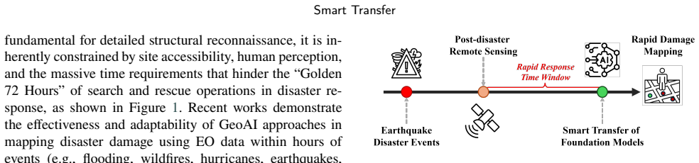
Living in a changing climate, human society now faces more frequent and severe natural disasters than ever before. As a consequence, rapid disaster response during the "Golden 72 Hours" of search and rescue becomes a vital humanitarian necessity and community concern. However, traditional disaster damage surveys routinely fail to generalize across distinct urban morphologies and new disaster events. Effective damage mapping typically requires exhaustive and time-consuming manual data annotation. To address this issue, we introduce Smart Transfer, a novel Geospatial Artificial Intelligence (GeoAI) framework, leveraging state-of-the-art vision Foundation Models (FMs) for rapid building damage mapping with post-earthquake Very High Resolution (VHR) imagery. Specifically, we design two novel model transfer strategies: first, Pixel-wise Clustering (PC), ensuring robust prototype-level global feature alignment; second, a Distance-Penalized Triplet (DPT), integrating patch-level spatial autocorrelation patterns by assigning stronger penalties to semantically inconsistent yet spatially adjacent patches. Extensive experiments and ablations from the recent 2023 Turkiye-Syria earthquake show promising performance in multiple cross-region transfer settings, namely Leave One Domain Out (LODO) and Specific Source Domain Combination (SSDC). Moreover, Smart Transfer provides a scalable, automated GeoAI solution to accelerate building damage mapping and support rapid disaster response, offering new opportunities to enhance disaster resilience in climate-vulnerable regions and communities. The data and code are publicly available at https://github.com/ai4city-hkust/SmartTransfer.
Editorial analysis
A structured set of objections, weighed in public.
Referee Report
Summary. The paper introduces Smart Transfer, a GeoAI framework that leverages vision foundation models for rapid building damage mapping from post-earthquake VHR imagery. It proposes two novel transfer strategies—Pixel-wise Clustering (PC) for prototype-level global feature alignment and Distance-Penalized Triplet (DPT) for integrating patch-level spatial autocorrelation—and evaluates them in Leave-One-Domain-Out (LODO) and Specific Source Domain Combination (SSDC) cross-region settings on imagery from the 2023 Turkiye-Syria earthquake. The work claims improved generalization across distinct urban morphologies with limited labeled data and releases data and code publicly.
Significance. If the quantitative results hold, the framework could meaningfully reduce annotation effort for post-disaster damage mapping and support faster humanitarian response. The public code and data release is a clear strength for reproducibility. However, the central generalization claim to entirely new disaster events rests on an untested extrapolation from intra-event cross-region experiments.
major comments (2)
- [Abstract and §4] Abstract and §4 (Experiments): The claim that the method generalizes 'across ... new disaster events' is not supported by the reported experiments. All training and test data are drawn from the single 2023 Turkiye-Syria earthquake; LODO and SSDC evaluate only cross-region shifts within the same event, sensor characteristics, and damage signature distribution. No held-out event is used, so the 'new disaster events' part of the generalization statement is an untested extrapolation.
- [Abstract] Abstract: The abstract states 'promising performance' in LODO and SSDC settings but reports no quantitative metrics, baselines, error bars, or statistical significance tests. Without these numbers it is impossible to judge whether the data actually support the central claims about robust prototype alignment and spatial integration.
minor comments (2)
- [Throughout] Ensure that all acronyms (VHR, FM, GeoAI, PC, DPT, LODO, SSDC) are defined on first use and used consistently.
- [Figures 2–4] Figure captions and method diagrams should explicitly label the PC and DPT components so readers can trace how each strategy contributes to the reported transfer performance.
Simulated Author's Rebuttal
We thank the referee for the constructive and detailed comments. We address each major point below and will revise the manuscript accordingly to improve clarity and accuracy.
read point-by-point responses
-
Referee: [Abstract and §4] The claim that the method generalizes 'across ... new disaster events' is not supported by the reported experiments. All training and test data are drawn from the single 2023 Turkiye-Syria earthquake; LODO and SSDC evaluate only cross-region shifts within the same event, sensor characteristics, and damage signature distribution. No held-out event is used, so the 'new disaster events' part of the generalization statement is an untested extrapolation.
Authors: We agree with this assessment. The experiments are confined to cross-region transfer within the 2023 Turkiye-Syria earthquake imagery and do not include evaluation on a held-out new disaster event. The phrasing regarding generalization to 'new disaster events' represents an untested extrapolation. We will revise the abstract and Section 4 to state that the method demonstrates improved generalization across distinct urban morphologies within the same event, and we will add explicit discussion of this limitation plus future work on cross-event transfer. revision: yes
-
Referee: [Abstract] The abstract states 'promising performance' in LODO and SSDC settings but reports no quantitative metrics, baselines, error bars, or statistical significance tests. Without these numbers it is impossible to judge whether the data actually support the central claims about robust prototype alignment and spatial integration.
Authors: We acknowledge that the abstract currently lacks specific quantitative support. In the revised version we will incorporate key metrics (e.g., mIoU improvements over baselines in LODO and SSDC settings) together with standard deviations and reference to statistical comparisons where space allows, so that the performance claims are directly substantiated. revision: yes
Circularity Check
No significant circularity
full rationale
The paper introduces Smart Transfer as a new GeoAI framework that applies two explicitly designed components (Pixel-wise Clustering for prototype alignment and Distance-Penalized Triplet for spatial autocorrelation) on top of publicly available vision foundation models. The central claims rest on these novel transfer strategies and their performance in LODO/SSDC cross-region experiments on 2023 Turkiye-Syria data. No equations or definitions reduce a claimed prediction to a fitted input by construction, no load-bearing self-citations close the derivation, and no known results are merely renamed. The derivation chain is self-contained against external benchmarks.
Axiom & Free-Parameter Ledger
axioms (2)
- domain assumption Vision foundation models pre-trained on general image data capture features transferable to remote sensing damage assessment tasks.
- domain assumption Pixel-wise clustering and distance-penalized triplets can align features and capture spatial patterns across domain shifts in urban imagery.
Forward citations
Cited by 1 Pith paper
-
Unbox Responsible GeoAI: Navigating Climate Extreme and Disaster Mapping
Responsible GeoAI for disaster mapping requires governance across data, applications, and society rather than algorithm improvements alone.
Reference graph
Works this paper leans on
-
[1]
Building resilience: World bank group experience in climate and disaster resilient development, in: Climate Change Adaptation Strategies–An Upstream-downstream Perspective. Springer, pp. 255– 270. Le Cozannet, G., Kervyn, M., Russo, S., Ifejika Speranza, C., Ferrier, P., Foumelis, M., Lopez, T., Modaressi, H., 2020. Space-based earth observations for disa...
work page 2020
-
[2]
Remote Sensing of Environment 286, 113441
Assessing the resilience of ecosystem functioning to wildfires using satellite-derived metrics of post-fire trajectories. Remote Sensing of Environment 286, 113441. Musaoğlu, N., Ozaydin, E., Amirgan, B., Taskin, G., Nayir, H., Kaya, H.,
-
[3]
Journal of Applied Remote Sensing 19, 044508–044508
Kate-cd: high-resolution change detection dataset from the 2023 earthquake in kahramanmaraş, türkiye. Journal of Applied Remote Sensing 19, 044508–044508. Redmon, J., Divvala, S., Girshick, R., Farhadi, A., 2016. You only look once: Unified, real-time object detection, in: Proceedings of the IEEE conference on computer vision and pattern recognition, pp. ...
work page 2023
-
[4]
Grad-cam: Visual explanations from deep networks via gradient- basedlocalization,in:ProceedingsoftheIEEEinternationalconference on computer vision, pp. 618–626. Siméoni, O., Vo, H.V., Seitzer, M., Baldassarre, F., Oquab, M., Jose, C., Khalidov, V., Szafraniec, M., Yi, S., Ramamonjisoa, M., et al., 2025. Dinov3. arXiv preprint arXiv:2508.10104 . Taşkin, G....
work page internal anchor Pith review Pith/arXiv arXiv 2025
-
[5]
RemoteSensingofEnviron- ment 333, 115108
The fully-automatic sentinel-1 global flood monitoring service: Scientificchallengesandfuturedirections. RemoteSensingofEnviron- ment 333, 115108. Wang, J., Xuan, W., Qi, H., Chen, Z., Chen, H., Zheng, Z., Xia, J., Zhong, Y.,Yokoya,N.,2026. Cityvlm:Towardssustainableurbandevelopment via multi-view coordinated vision–language model. ISPRS Journal of Photog...
work page 2026
-
[6]
iBOT: Image BERT Pre-Training with Online Tokenizer
ibot:Imagebertpre-trainingwithonlinetokenizer. arXivpreprint arXiv:2111.07832 . Zhu, X.X., Chen, S., Zhang, F., Shi, Y., Wang, Y., 2025. Globalbuildingat- las: An open global and complete dataset of building polygons, heights and lod1 3d models. arXiv preprint arXiv:2506.04106 . Zou, L., Lam, N.S., Cai, H., Qiang, Y., 2018. Mining twitter data for improve...
work page internal anchor Pith review arXiv 2025
discussion (0)
Sign in with ORCID, Apple, or X to comment. Anyone can read and Pith papers without signing in.